| Keiraville Wollongong, New South Wales | |||||||||||||||
|---|---|---|---|---|---|---|---|---|---|---|---|---|---|---|---|
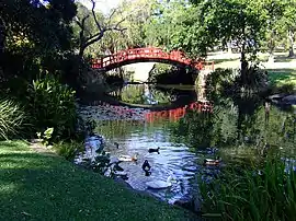
 Wollongong Botanic Garden | |||||||||||||||
 Keiraville | |||||||||||||||
| Coordinates | 34°23′S 150°52′E / 34.383°S 150.867°E | ||||||||||||||
| Population | 3,070 (2016 census)[1] | ||||||||||||||
| • Density | 930/km2 (2,410/sq mi) | ||||||||||||||
| Postcode(s) | 2500 | ||||||||||||||
| Elevation | 40 m (131 ft) | ||||||||||||||
| Area | 3.3 km2 (1.3 sq mi) | ||||||||||||||
| Location |
| ||||||||||||||
| LGA(s) | City of Wollongong | ||||||||||||||
| State electorate(s) | Keira | ||||||||||||||
| Federal division(s) | Cunningham | ||||||||||||||
| |||||||||||||||
Keiraville is an inner suburb of the city of Wollongong, New South Wales, Australia in the Illawarra region. It is situated in the foothills of Mount Keira, approximately three kilometres northwest of Wollongong.
Description

Keiraville has a public school (the Keiraville Public School[2]), post office and several shops located on Gipps Road.
Keiraville (and its neighbour Gwynneville) is known as a university town, home to the main campus of the University of Wollongong.
Another major landmark, Wollongong Botanic Garden, is situated between Northfields Avenue and Murphys Avenue, and includes the Wollongong Conservatorium of Music.
Heritage listings
Keiraville has a number of heritage-listed sites, including:
- Murphys Avenue: Gleniffer Brae[3]
Population
In the 2022 Census,[4] there were 4,002 people in Keiraville. 66.9% of people were born in Australia. The next most common countries of birth were China 9.1%, and England 3.0%. 71.1% of people spoke only English at home. Other languages spoken at home included Mandarin at 9.1%. The most common responses for religion were No Religion 36.8%, Catholic 18.8% and Anglican 13.2%.[1]
See also
References
- 1 2 Australian Bureau of Statistics (27 June 2017). "Keiraville (State Suburb)". 2016 Census QuickStats. Retrieved 15 July 2017.
 Material was copied from this source, which is available under a Creative Commons Attribution 4.0 International License.
 - ↑ "Keiraville Public School | Home". Archived from the original on 19 February 2011. Retrieved 1 November 2010.
- ↑ "Gleniffer Brae". New South Wales State Heritage Register. Department of Planning & Environment. H00557. Retrieved 18 May 2018.
 Text is licensed by State of New South Wales (Department of Planning and Environment) under CC-BY 4.0 licence.
 - ↑ "2021 Keiraville, Census All persons QuickStats | Australian Bureau of Statistics". www.abs.gov.au. Retrieved 1 September 2022.