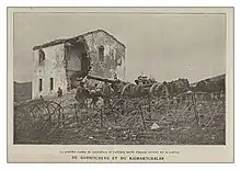
Kella (Greek: Κέλλα, before 1926: Γκορνίτσοβον - Gkornitsovon;[1] Bulgarian/Macedonian: Горничево, Gorničevo or Gornichevo) is a village in the Amyntaio municipality of the Florina regional unit, Greece.[2]
History
The village was first mentioned in an Ottoman defter of 1468, where it is listed under the name of Gorničevo and described as a small settlement of thirty households. A second defter of 1481 records that the number had increased by only three households.[3]
Around 1840, the land of the village was forcibly seized by the Muslim notable Ilyaz Pasha and it was turned into a homestead. Later, the local residents were able to redeem their property.[4]
In the book “Ethnographie des Vilayets d'Adrianople, de Monastir et de Salonique”, published in Constantinople in 1878, that reflects the statistics of the male population in 1873, Gornitchévo was noted as a village with 160 households, 522 Bulgarian and 50 Romani inhabitants.[5]
Kella had 877 inhabitants in 1981.[6] In fieldwork done by Riki Van Boeschoten in late 1993, Kella was populated by Slavophones.[6] The Macedonian language was used by people of all ages, both in public and private settings, and as the main language for interpersonal relationships.[6] Some elderly villagers had little knowledge of Greek.[6]
Notes
- ↑ "Name Changes of Settlements in Greece: Gkornitsovon – Kella". Pandektis. Retrieved 30 March 2022.
- ↑ Δημοτικό Διαμέρισμα Κέλλης. Δήμος Αμυνταίου (in Greek). Archived from the original on January 9, 2008. Retrieved 2009-01-05.
- ↑ Kravari, Vassiliki (1989). Villes et villages de Macédoine occidentale. Réalités byzantines (in French). Vol. 2. Paris: Editions P. Lethielleux. p. 263. ISBN 2-283-60452-4.
- ↑ Дебърски глас, година 2, брой 32, 22 февруари 1911, с. 2. - "Завладяните по тоя начин села са имали нещастието дълго време да бъдат чифлигари. По-после селяните са били заставяни с терор да откупуват с пари от пашата собствените си имоти, усвоени насила от него. По същия начин са се откупили полските села в Дебърско - Макелари, Клабучища, както и селата в Битолско - Остроро, Угорничево, в Ресенско - ..."
- ↑ Македония и Одринско. Статистика на населението от 1873 г. Македонски научен институт, 1995. стр. 82-83. (in Bulgarian)
- 1 2 3 4 Van Boeschoten, Riki (2001). "Usage des langues minoritaires dans les départements de Florina et d'Aridea (Macédoine)" [Use of minority languages in the departments of Florina and Aridea (Macedonia)]. Strates. 10. Table 3: Kelli, 877; S, M1; S = Slavophones, M = macédonien"
40°47′N 21°41′E / 40.783°N 21.683°E