Kelmė District Municipality
Kelmės rajono savivaldybė | |
|---|---|
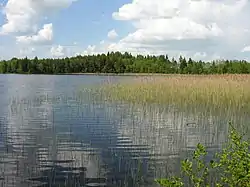
 Žiaunė lake | |
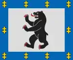
 Coat of arms | |
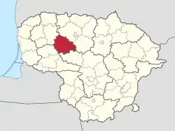
 Location of Kelmė district municipality within Lithuania | |
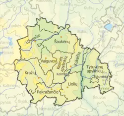
 Map of Kelmė district municipality | |
| Country | |
| Ethnographic region | Samogitia |
| County | Šiauliai County |
| Capital | Kelmė |
| Elderships | 11 |
| Area | |
| • Total | 1,705 km2 (658 sq mi) |
| • Rank | 8th |
| Population (2021[1]) | |
| • Total | 26,026 |
| • Rank | 27th |
| • Density | 15/km2 (40/sq mi) |
| • Rank | 45th |
| Time zone | UTC+2 (EET) |
| • Summer (DST) | UTC+3 (EEST) |
| Telephone code | 427 |
| Major settlements | |
| Website | www |
Kelmė District Municipality is one of 60 municipalities in Lithuania, located in western part of Lithuania.
Elderships
Kelmė District Municipality is divided into 11 elderships:
| Eldership (Administrative Center) | Area | Population (2021) |
|---|---|---|
| Kelmė Vicinity (Kelmė) | 133.7 km2 (33,037.99 acres; 51.62 sq mi) | 2,022 |
| 7.85 km2 (1,939.78 acres; 3.03 sq mi) | 7,688 | |
| 255 km2 (63,011.87 acres; 98.46 sq mi) | 2,050 | |
| Kukečiai (Kukečiai) | 120 km2 (29,652.65 acres; 46.33 sq mi) | 1,322 |
| 155 km2 (38,301.33 acres; 59.85 sq mi) | 1,947 | |
| Pakražantis (Griniai) | 160 km2 (39,536.86 acres; 61.78 sq mi) | 1,643 |
| 250 km2 (61,776.35 acres; 96.53 sq mi) | 1,875 | |
| 286.72 km2 (70,850.05 acres; 110.70 sq mi) | 2,414 | |
| 9.8 km2 (2,421.63 acres; 3.78 sq mi) | 1,850 | |
| 234 km2 (57,822.66 acres; 90.35 sq mi) | 2,493 | |
| 91 km2 (22,486.59 acres; 35.14 sq mi) | 722 |
References
- ↑ "Archived copy". Archived from the original on 2022-03-07. Retrieved 2022-12-09.
{{cite web}}: CS1 maint: archived copy as title (link)
55°40′26″N 22°51′04″E / 55.67389°N 22.85111°E
This article is issued from Wikipedia. The text is licensed under Creative Commons - Attribution - Sharealike. Additional terms may apply for the media files.
