Keningau Airport Lapangan Terbang Keningau | |||||||||||
|---|---|---|---|---|---|---|---|---|---|---|---|
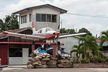
 The main entrance to Keningau Airport | |||||||||||
| Summary | |||||||||||
| Airport type | Private and public | ||||||||||
| Owner | Government of Malaysia | ||||||||||
| Operator | Malaysia Airports Holdings Berhad | ||||||||||
| Serves | Keningau, Sabah, Malaysia | ||||||||||
| Location | Interior Division, Sabah, East Malaysia | ||||||||||
| Time zone | MST (UTC+08:00) | ||||||||||
| Elevation AMSL | 1,036 ft / 316 m | ||||||||||
| Coordinates | 05°21′19″N 116°09′54″E / 5.35528°N 116.16500°E | ||||||||||
| Map | |||||||||||
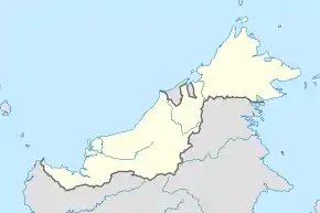
 WBKG Location in Malaysia | |||||||||||
| Runways | |||||||||||
| |||||||||||
Keningau Airport (Malay: Lapangan Terbang Keningau) (IATA: KGU, ICAO: WBKG), alternately Keningau Airstrip, is a privately owned domestic airport serving the city of Keningau in the state of Sabah, Malaysia. It is 2.5 km from Keningau Town.
History

Many years ago, the Keningau Airport was used for aeroplanes with a small capacity like the BN-2 Islander and Fokker F27. The last flight to Keningau Airport for Malaysia Airlines was in the 1970s.
Future
Parti Bersatu Sabah (PBS) Bingkor urged the State Government to explain its plan to use up 46,000 hectares of Keningau airport reserve land.[2]
However, almost a dozen NGOs and Chinese associations here opposed the proposed cancellation of part of the 46,800 hectare airport reserve land on the Keningau-Apin-Apin road.
APS Vice President Paul Kadau claimed Kg Tuarid Liawan residents appealed for the relocation of the villagers to the Keningau Airport reserve land but it was rejected at that time. He said the airport is currently used by the Microlight Flight Sports Club. “It is understood that the Keningau Airport is privately owned and the question is who is the person? “Has the matter been brought up and discussed in the Sabah State Legislative Assembly?” he asked.[3]
See also
References
- ↑ AIP Malaysia: Index to Aerodromes at Department of Civil Aviation Malaysia
- ↑ Daily Express(17 July 2023).
- ↑ Daily Express(14 July 2023).