Carmyle
| |
|---|---|
 Carmyle Location within the Glasgow City council area  Carmyle Location within Scotland | |
| OS grid reference | NS651618 |
| Council area | |
| Lieutenancy area |
|
| Country | Scotland |
| Sovereign state | United Kingdom |
| Post town | GLASGOW |
| Postcode district | G32 |
| Dialling code | 0141 |
| Police | Scotland |
| Fire | Scottish |
| Ambulance | Scottish |
| UK Parliament | |
| Scottish Parliament | |
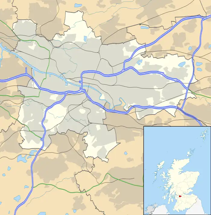
Carmyle (/kɑːrˈmaɪl/; Scottish Gaelic: An Càrn Maol) is a suburb in the east end of Glasgow, Scotland, directly north of the River Clyde. It is in an isolated location separated from the main urban area of the city and has the characteristics of a semi-rural village. Administratively, Carmyle falls under the Shettleston ward of Glasgow City Council.
History
Carmyle as a place name, originally appears as a gift of the lands by Herbert, the Bishop of Glasgow (1147–1164) to the Cistercian Abbey of Neubotle (Newbattle, in Midlothian). This abbey had been established a few years previously by David I, whose mother, the saintly Margaret, Queen of Scotland and wife of king Malcolm III Ceanmore, had done so much to sow the seeds of Christianity in early Scotland.
The name Carmyle is derived from Cumbric and translates as "bare town". The reason for this may not be too difficult to find. Originally, most of the land north of Carmyle and Tollcross was forest and brushwood, giving excellent cover for wild animals, but the strips of land alongside the river banks were very rich for cultivating. Therefore, the lands in and around Carmyle were probably cleared at an early date, so as to give room for successful agriculture. "Bare town" would be quite appropriate in the circumstances. The village has within it a residence of the Verona Fathers, in the property once known as Carmyle House.
Following on its becoming an attribute of the church through Bishop Herbert, the district was confirmed to the monks from time to time by succeeding kings and popes. A note appended to the transcript of a papal bull, dated 1263, shows that the monks had ceased to be owners, for the time being. How the change occurred is explained in a charter granted by John Cheyam, Bishop of Glasgow, on 11 June 1268. It appears that the bishop had, with his own money and with the help of Sir Reginald of Irewyn, Archdeacon of Glasgow, purchased, or redeemed, the land of Kermil. Being zealous for the increase of divine service in Glasgow Cathedral, he dedicated the property (except the new mill which he had erected on the water of the Clyde) for sustenance of three chaplains or priests, to celebrate divine service in the cathedral for the souls of the predecessors and successors of Archdeacon Reginald. Bishop John's pious arrangement, however, seems to have been disregarded by Robert Wishart, the succeeding bishop. His interference led the dean and chapter to appeal to the Pope in 1275, for redress. The bishops of Dunblane and Argyle were commanded by the Pope to investigate the matter, but the outcome was never documented.
The district and village were known by various names, including Carmyld, Karmyle, Kermil, Neddyr Carmyle, Overe Carmyle and Wester Carmyled. The name Hutchesoune was applied to the district called Nether Carmyle, having been added in or about the year 1579, to the lands now owned by Thomas Hutcheson. His two sons were the founders of the hospital and school in Glasgow, bearing their name.[1]
Location
Due to its physical isolation from the main built-up areas of Glasgow, Carmyle has something of a rural village character as opposed to a neighbourhood in a city. The River Clyde runs directly to the south, opposite the Westburn neighbourhood of Cambuslang (South Lanarkshire) – the banks were previously connected for pedestrians by the Westburn Viaduct, a disused rail bridge, but that has now been blocked off.[2] The Scottish Fire and Rescue Service National Training Centre (2013) and Clydesmill Community Fire Station (2011) are also on the southern bank of the river, on the site of the large Clydesmill Power Station which was present for most of the 20th century.[3][4]
To the north, the closest parts of Glasgow (on the other side of railway lines and the M74 motorway) are Auchenshuggle, Foxley and Mount Vernon. There is a large industrial estate to the west of Carmyle (built on the site of the Clyde Iron Works, in operation from the late 18th to late 20th century).
Land to the east at Kenmuir is undeveloped, some being abandoned farmland and coal workings; the farm was known for its unconventional owner during the latter 20th century who had the farmhouse extended,[5] but it was abandoned to become ruined a few yards south of the motorway[6][7] after the owner lost a court case in relation to its construction.[8] In the 2010s, plans were outlined for much of this land to be developed for housing as a 'Community Growth Area'.[9][10][11]
Transport
Carmyle railway station which opened in August 1866, closed in 1964 but then re-opened again in 1993, is on the Whifflet Line. It is an unstaffed, 2-platform halt.[12] Trains run to Glasgow Central and Rutherglen from Westbound Platform 1, and to Mount Vernon, Baillieston, Bargeddie, Kirkwood and Whifflet from Eastbound Platform 2. The service is operated by ScotRail.
The village also has bus services to Glasgow city centre, The Forge Shopping Centre (Parkhead) and Cambuslang, although these are not among the main routes in the region.[13][14]
The village is also close to the M74 motorway giving easy access to Scotland's central belt, the Scottish Borders and beyond. Construction on the extension project extending the M74 from Carmyle to Glasgow City Centre began in May 2008 and was completed in 2011.[15]
Places of worship
Carmyle Church
The current Carmyle Church of Scotland situated in Carmyle Avenue[16] was built in 1907, costing an estimated £2,500. The style is Scottish baronial revival, mainly in imitation rubble work, with a machicolated belltower featuring the eccentricity of an onion dome for a belfry (actually a helmet dome). The Church was formally opened with a dedication service held on Thursday 7 March 1907, and performed by the Rev. Alex White, D.D., of St Georges, Edinburgh. As well as weekly services the church is used by the local community for Brownies, Mother and Toddler groups and a regular thrift shop. Carmyle Church is a linked charge with Kenmuir Mount Vernon Church of Scotland on London Road, with the one minister serving both congregations. Both Carmyle and Kenmuir are also linked via a parish grouping with Sandyhills Church of Scotland. Services are held at Carmyle Church every Sunday at 12:00pm.
St Joachim’s RC Church

Like so many other areas in the west of Scotland, the Reformation and foundation of the Protestant Reformed Kirk saw the almost complete removal of the Catholic faith from Carmyle and the land transferred into secular hands. It was not until 1829 and the Roman Catholic Relief Act 1829 that punitive laws against Catholicism were relaxed and the old Church begin to re-establish itself in Scotland. There had been an influx of Catholics from the Highlands as well as from Ireland during the progress of the Industrial Revolution and this was reflected in the growing population of Carmyle. However, it was not until the mid-20th century that numbers increased to the extent that the area warranted provision independent of St Joseph's Tollcross parish, of which it had until then formed a part.
From March 1954, the priests of St Joseph's used the local Welfare Hall to provide services to the Catholics of Carmyle, with the parish being established under the patronage of St. Joachim in July.
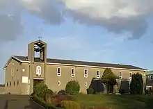
Carmyle Mains Steading farm on River Road was obtained and from a state of dereliction was transformed into a Chapel Hall over a 10-month period to June 1955 by the local folk. Progress continued apace and a new church (designed by Coia) was built on an elevated piece of land at the end of Inzievar Terrace, opening in September, 1957 – the present St Joachim's. The parish is located within the Glasgow Archdiocese, although the village itself was not incorporated into the city until 1975 with the revision of local government boundaries.[17]
Primary schools
Carmyle Primary School achieved small notoriety in the mid-1970s when it was rebuilt in a flying saucer/open plan design, a rarity in Scotland at the time. The school was subsequently rebuilt as a modern open-plan building after its demolition in 1993 following a fire.
St Joachim's Primary School is affiliated with the Catholic Church of the same name. It, too, was built in the same flying saucer design as Carmyle Primary (as was the since-rebuilt James Aiton Primary in Cambuslang), to a design by Edward Allan. St Joachim's Primary was built in 1975,[1] but it also suffered a fire, necessitating its demolition. It was rebuilt to a new design in the early 1980s.
Leisure
Carmyle has one public house and two bowling greens. The Auld Boat Hoose, or "bottom shop" in River Road, opposite the spot where a boat would ferry people across the Clyde from the Cambuslang side.[1] The former Auld Hoose, or "tap shop", round the corner, a few hundred yards up Carmyle Avenue, has since closed, been demolished, and its site been reoccupied by housing.
Carmyle Bowling Club is situated one hundred yards from the "bottom shop" and has been a member of the Glasgow and Scottish Bowling Associations since the 1960s. Foxley Bowling Club in Carmyle Avenue was instituted in 1914, taking its name from the local estate called Foxley. Several residents of Carmyle are members and a friendly rivalry exists between the two clubs.[18]
Walter Smith
Walter Smith, although born in Lanark, grew up in the Gardenside area of Carmyle.[18] He went on to become one of the most successful managers in the history of Rangers F.C. across two spells in charge, and also managed the Scotland national football team.[19]
Clydeford Bridge

Built in 1976, the Clydeford Bridge[20] carries vehicles and pedestrians over the Clyde on the A763 road towards an industrial suburb on the site of the Clyde Iron Works, and towards the M74 motorway and A74 road. The bridge is located to the north-east of Cambuslang and the south-west of Carmyle. Its name derives from Clydeford Road which runs north from Cambuslang Main Street to the river, which was itself named after an ancient ford across the water at a nearby point. It was built to replace the Cambuslang Bridge (built 1892) located to the west - that bridge has never been demolished although it is closed to traffic.[21]
On the south side of the Clydeford bridge at the Clyde Walkway and National Cycle Route 75 is a metallic wire sculpture of a wading bird created in 1998 by noted sculptor Andy Scott. It is known as the Carmyle Heron (although it is actually on the Cambuslang side of the river).
References
- 1 2 3 "Carmyle". East End Glasgow History. 1 March 2010. Archived from the original on 14 November 2016.
- ↑ Westburn (Carmyle) Viaduct, Forgotten Relics, 2017
- ↑ "Glasgow, Clydesmill Power Station". canmore.org.uk. Retrieved 20 March 2020.
- ↑ Cambuslang Industrial History (page 67), Colin Findlay, 22 November 2013
- ↑ Jimmy Wilsons Farm, Carmyle, Urban Glasgow, 13 July 2010
- ↑ In Ruins: Abandoned Houses in Carmyle, Visions of a Madman, 6 July 2012
- ↑ Kenmuir Road – a fond memory, Secret Scotland, 4 February 2018
- ↑ Horseplay in court earns Glasgow farmer a #450 fine, The Glasgow Herald, 19 August 1995
- ↑ Baillieston Broomhouse Carmyle Community Growth Area: Report by New City Vision (Carmyle) Ltd & AS Carmyle Ltd, Glasgow Community Planning Partnership, 26 April 2018
- ↑ Places: Kenmuir Development, TCN
- ↑ Kenmuir Farm, Glasgow, Manor Investments
- ↑ Carmyle Station Info Archived 9 September 2010 at the Wayback Machine
- ↑ "Frequency Guide" (PDF). First Glasgow. 1 January 2018. Retrieved 20 September 2019.
- ↑ "Glasgow Network Map" (PDF). First Glasgow. 1 January 2018. Retrieved 20 September 2019.
- ↑ M74 Completion, Transport Scotland
- ↑ Home Page, Carmyle and Kenmuir Mount Vernon Church of Scotland
- ↑ "St Joachim Carmyle". East End Glasgow History.
- 1 2 "Carmyle recollections - Leisure activities". East End Glasgow History. 1 March 2010. Retrieved 10 October 2017.
- ↑ "Manager profile: Walter Smith". Official website. Rangers F.C. Retrieved 10 October 2017.
- ↑ Clydeford Bridge at Gazetteer for Scotland
- ↑ "Glasgow, Cambuslang, Clydeford Road Bridge". Canmore.
External links
 Media related to Carmyle at Wikimedia Commons
- Carmyle at Gazetteer for Scotland

