Kenvir, Kentucky | |
|---|---|
 Kenvir  Kenvir | |
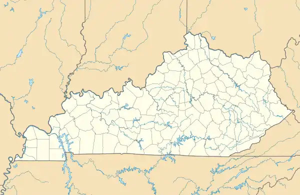
| Coordinates: 36°51′13″N 83°09′26″W / 36.85361°N 83.15722°W | |
| Country | United States |
| State | Kentucky |
| County | Harlan |
| Area | |
| • Total | 0.29 sq mi (0.76 km2) |
| • Land | 0.29 sq mi (0.76 km2) |
| • Water | 0.00 sq mi (0.00 km2) |
| Elevation | 1,457 ft (444 m) |
| Population (2020) | |
| • Total | 204 |
| • Density | 698.63/sq mi (269.53/km2) |
| Time zone | UTC-5 (Eastern (EST)) |
| • Summer (DST) | UTC-4 (EDT) |
| ZIP code | 40828[2] |
| Area code | 606 |
| GNIS feature ID | 495684[3] |
Kenvir is a census-designated place and unincorporated community in Harlan County, Kentucky, United States. Its population was 297 as of the 2010 census.[4]
Demographics
| Census | Pop. | Note | %± |
|---|---|---|---|
| 2020 | 204 | — | |
| U.S. Decennial Census[5] | |||
References
- ↑ "2020 U.S. Gazetteer Files". United States Census Bureau. Retrieved March 18, 2022.
- ↑ "Kenvir KY ZIP Code". zipdatamaps.com. 2023. Retrieved June 16, 2023.
- ↑ "Kenvir". Geographic Names Information System. United States Geological Survey, United States Department of the Interior.
- ↑ "U.S. Census website". United States Census Bureau. Retrieved May 14, 2011.
- ↑ "Census of Population and Housing". Census.gov. Retrieved June 4, 2016.
Municipalities and communities of Harlan County, Kentucky, United States | ||
|---|---|---|
| Cities | 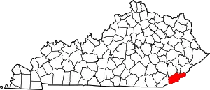 Location of Harlan County, Kentucky | |
| CDPs | ||
| Other unincorporated communities |
| |
| Ghost towns | ||
This article is issued from Wikipedia. The text is licensed under Creative Commons - Attribution - Sharealike. Additional terms may apply for the media files.