Kfarfou
كفرفو | |
|---|---|
City | |
 Kfarfou Location within Lebanon | |
| Coordinates: 34°19′05″N 35°52′48″E / 34.31806°N 35.88000°E | |
| Country | |
| Governorate | North Governorate |
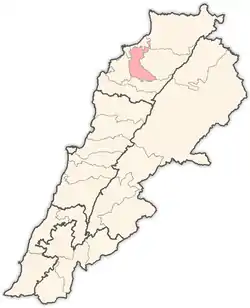
| District | Zgharta District |
| Elevation | 607 m (1,991 ft) |
| Time zone | UTC+2 (EET) |
| • Summer (DST) | UTC+3 (EEST) |
| Dialing code | +961 |

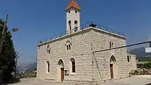
The church of the village
Kfarfou (also Kfar Fou, Kfarfu, Arabic: كفرفو) is a village located in the Zgharta District in the North Governorate of Lebanon.[1] Its population is Maronite Catholic.
References
External links
Capital: Zgharta | ||
| Towns and villages |
|  |
| Notable landmarks | ||
| History | ||
| Notable people |
| |
This article is issued from Wikipedia. The text is licensed under Creative Commons - Attribution - Sharealike. Additional terms may apply for the media files.