Khoirabari | |
|---|---|
Town | |
| Khoirabari Town | |
 Khoirabari Town | |
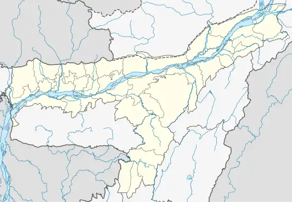
 Khoirabari Location in Assam, India  Khoirabari Khoirabari (India) | |
| Coordinates: 26°42′43″N 92°12′20″E / 26.71194°N 92.20556°E | |
| Country | |
| State | Assam |
| Region | North Assam |
| District | Udalguri |
| Khoirabari Municipal Board | 1 February 1956 |
| Founded by | Government of Assam |
| • Sex ratio | 871 (male:female) ♂/♀ |
| Government | |
| • Type | Municipality |
| • Body | Khoirabari Municipal Board |
| Area | |
| • Total | 56.93 ha (140.68 acres) |
| Population (2011) | |
| • Total | 873 |
| • Male | 443 |
| • Female | 430 |
| Demonym | Khoirabarian |
| Language | |
| • Official | Assamese, Bodo |
| Demographics | |
| • Literacy | |
| Time zone | UTC+05:30 (IST) |
| PIN | 784522 |
| Telephone code | 03711 |
| Vehicle registration | AS-27 (Udalguri) |
| Lok Sabha constituency | Mangaldoi |
| Vidhan Sabha constituency | Panery |
| Nearest cities to Khoirabari | Rangia, Mangaldoi, Nalbari, Udalguri, Guwahati |
| Summer and Winter Temperature | 24°C - 38°C in Summer 10°C - 22°C in Winter |
| Website | https://udalguri.assam.gov.in/ |
Khoirabari is a town and a municipal board in Udalguri district in the Indian state of Assam.[1] Khoirabari serves as the Sub-divisional headquarters of Khoirabari Sub-division.[2] The total geographical area of town is 56.93 hectares. Khoirabari Town has a total population of 873 peoples, out of which male population is 443 while female population is 430.[3] Literacy rate of Khoirabari town village is 80.64% out of which 85.10% males and 76.05% females are literate.[4][5]
There are about 214 houses in Khoirabari town village.[6] Pincode of Khoirabari town village locality is 784522. Khoirabari is located 40 KM towards west from District headquarters Udalguri.[7] It is a Tehsil head quarter. Rangia, Mangaldoi, Nalbari, Guwahati are the nearby Cities to Khoirabari.[8]
Demographics
As of 2011 India census, Khoirabari had a population of 873.[9] Males constitute 52% of the population and females 48%. Khoirabari has an average literacy rate of 74%, higher than the national average of 59.5%: male literacy is 80%, and female literacy is 69%.
Assamese, Bodo and Bengali are the major language. But the most commonly spoken languages include Bodo is spoken widely in the surrounding areas.[10] The locals can even interact in Hindi.
A number of tea gardens are located nearby and Khoirabari is the nearest commercial access point for them.[11]
Education
Educational Institutions include[12]
Transportation
Roads

National Highway 16 passes from the heart of the town[15]
Railways

Nearest railway station of Khoirabari is Khoirabari railway station[16] on Rangiya–Murkongselek section under Rangiya railway division of Northeast Frontier Railway zone.[17] Rangiya Junction railway station for Mail, passenger Trains
Airways

The nearest airport of Khoirabari is LGBI Airport, Guwahati[18]
Facilities
- Nearest railway station: Khoirabari railway station[19][20]
- Khoirabari Nearest Airport : LGBI Airport (Guwahati)[21]
- Nearest hospital: Khoirabari Gramin Hospital.[22][23]
Major festivals
Rongali Bihu and Boisagu are in April; Durga Puja in October; Diwali and Holy also celebrated across Khoirabari and surrounding areas.[24][25]
See also
References
- ↑ News, India TV. "Khoirabari Pin Code | Postal Code (Zip Code) of Khoirabari, Darrang, Assam, India". www.indiatvnews.com. Retrieved 29 December 2023.
{{cite web}}:|last=has generic name (help) - ↑ "Pin Code of Khoirabari , Udalguri, Assam, India". indiapincodes.net. Retrieved 29 December 2023.
- ↑ "Make My Trip | Khoirabari".
- ↑ "Villages & Towns in Khoirabari Circle of Darrang, Assam". www.census2011.co.in. Retrieved 29 December 2023.
- ↑ "Khoirabari (Pt) Taluk Population Udalguri, Assam, List of Villages & Towns in Khoirabari (Pt) Taluk". Censusindia2011.com. Retrieved 17 January 2024.
- ↑ "Maps, Weather, and Airports for Khoirabari, India". www.fallingrain.com. Retrieved 29 December 2023.
- ↑ "Contact Us Page | Udalguri District | Government Of Assam, India". udalguri.assam.gov.in. Retrieved 17 January 2024.
- ↑ "Khoirabari Railway Station | railmitra.com".
- ↑ "Weather Forecast | Khoirabari".
- ↑ "Khoirabari to Dhekiajili Road Trains | Book from 1 Trains, Fare, Time Table". www.ixigo.com. Retrieved 30 December 2023.
- ↑ "Map of Khoirabari, Assam | Udalguri district | mapsofindia.com".
- ↑ "Schools in Khoirabari (Udalguri) | Cluster wise List of Schools in Khoirabari - Udalguri (Assam)". schools.org.in. Retrieved 30 December 2023.
- ↑ "Khoirabari College". 28 August 2023. Retrieved 30 December 2023.
- ↑ "Khoirabari Higher Secondary School | Assam | babrone.edu.in".
- ↑ "State Highways | Public Works (Roads) | Government Of Assam, India". pwdroads.assam.gov.in. Retrieved 17 January 2024.
- ↑ "Trains from Khoirabari Railway Station | Khoirabari, Assam | nativeplanet.com".
- ↑ "Welcome to North East Frontier Railway / Indian Railways Portal / Rangiya railway division". nfr.indianrailways.gov.in. Retrieved 17 January 2024.
- ↑ "Air Cargo Complex (LGBI Airport) | Assam Industrial Development Corporation Ltd | Government Of Assam, India". aidcltd.assam.gov.in. Retrieved 17 January 2024.
- ↑ "Jhargram to Khoirabari Transport & Logistics Services - Online Truck Booking to Khoirabari from Jhargram - WheelsEye". wheelseye.com. Retrieved 17 January 2024.
- ↑ "Duni to Khoirabari cabs from ₹2553 | Book taxi online : Gozo Cabs". www.gozocabs.com. Retrieved 17 January 2024.
- ↑ "Lokpriya Gopinath Bordoloi International Airport | LGBI Airport | Assam".
- ↑ "Khoirabari CHC Community Health Center - Address and Reviews - Khoirabari Chc Building, Olongbar High School, Khoirabari-batamari Road, Khoirabari Block Primary Health Center, Udalguri, Assam - Phone Number - TabletWise". aarogya.us. Retrieved 30 December 2023.
- ↑ "Khoirabari | Udalguri | Assam".
- ↑ "Khoirabari (PT) | Subdistrict | GeoIQ". geoiq.io. Retrieved 30 December 2023.
- ↑ "Khoirabari (Pt) - Population, Sex Ratio, Literacy & Workforce". 24 February 2023. Retrieved 17 January 2024.