Kiheka Township | |
|---|---|
 | |
| Coordinates: 38°01′47″N 092°41′03″W / 38.02972°N 92.68417°W | |
| Country | United States |
| State | Missouri |
| County | Camden |
| Area | |
| • Total | 42.12 sq mi (109.08 km2) |
| • Land | 41.61 sq mi (107.76 km2) |
| • Water | 0.51 sq mi (1.32 km2) 1.21% |
| Elevation | 728 ft (222 m) |
| Population (2000) | |
| • Total | 4,237 |
| • Density | 101.8/sq mi (39.3/km2) |
| FIPS code | 29-38585[2] |
| GNIS feature ID | 1729741 |
Kiheka Township is one of eleven townships in Camden County, Missouri, USA. As of the 2000 census, its population was 4,237.
Geography
Kiheka Township covers an area of 42.12 square miles (109.1 km2) and contains no incorporated settlements. It contains six cemeteries: Caviness, Davis, Hugo, Percival Memorial, Williams and Zion.
The stream of Watered Hollow Branch runs through this township.
Transportation
Kiheka Township contains one airport or landing strip, Heritage Landing Strip.
References
- ↑ "US Board on Geographic Names". United States Geological Survey. October 25, 2007. Retrieved January 31, 2008.
- ↑ "U.S. Census website". United States Census Bureau. Retrieved January 31, 2008.
External links
Municipalities and communities of Camden County, Missouri, United States | ||
|---|---|---|
| Cities | 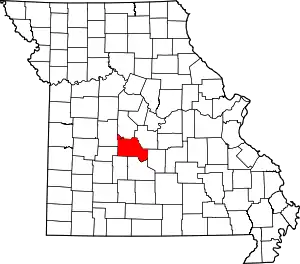 Map of Missouri highlighting Camden County | |
| Villages | ||
| Townships | ||
| CDPs | ||
| Other communities | ||
| Footnotes | ‡This populated place also has portions in an adjacent county or counties | |
This article is issued from Wikipedia. The text is licensed under Creative Commons - Attribution - Sharealike. Additional terms may apply for the media files.