Kings Sutton | |
|---|---|
.png.webp) | |
| General information | |
| Location | King's Sutton, West Northamptonshire England |
| Coordinates | 52°01′16″N 1°16′52″W / 52.021°N 1.281°W |
| Grid reference | SP494360 |
| Managed by | Chiltern Railways |
| Platforms | 2 |
| Other information | |
| Station code | KGS |
| Classification | DfT category F2 |
| History | |
| Original company | Great Western Railway |
| Pre-grouping | Great Western Railway |
| Post-grouping | Great Western Railway |
| Key dates | |
| 1 December 1873 | Opened as King's Sutton |
| 2 November 1964 | Renamed King's Sutton Halt |
| 6 May 1968 | Renamed Kings Sutton |
| Passengers | |
| 2018/19 | |
| 2019/20 | |
| 2020/21 | |
| 2021/22 | |
| 2022/23 | |
| Location | |
| Notes | |
Passenger statistics from the Office of Rail and Road | |
Kings Sutton railway station serves the village of King's Sutton in Northamptonshire, England. It is also one of the nearest railway stations to the town of Brackley. The station is managed by Chiltern Railways, who provide most of the services, including from London Paddington and Marylebone to Oxford and Banbury.
History
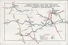
The Great Western Railway built the Oxford — Banbury section of the Oxford and Rugby Railway between 1845 and 1850. However, the GWR did not open a station at King's Sutton until 1872.[1] By 1881 the arrival of the Banbury and Cheltenham Direct Railway via Chipping Norton had made King's Sutton a junction. British Railways withdrew passenger services between King's Sutton and Chipping Norton in 1951 and closed the B&CDR line to freight traffic in 1964. The station was reduced to an unstaffed halt from 2 November 1964.[2] BR removed King's Sutton station footbridge in the 1960s and replaced it with a signal-controlled barrow crossing at the North end of the platform. An incident in early 2005 where a passenger was nearly hit by an express train saw the Northbound platform closed for a short period whilst security guards were brought in to man the crossing. This led to work starting on a new bridge in late 2005 and completion in May 2006.[3] The old passenger shelter on the up platform was replaced by a new plastic and metal 'bus-shelter' style one.
A late night robbery in 2001 led Chiltern Railways to raise security concerns. As a result, CCTV cameras were installed in 2002.
Kings Sutton is the least used station in the county of Northamptonshire.[4]
Routes and operators

Services at King's Sutton are operated by Chiltern Railways and Great Western Railway.
Chiltern Railways operate services approximately every two hours off peak between London Marylebone and Banbury with the majority of these extended to Stratford-upon-Avon. On Sundays, these services are extended beyond Banbury to Birmingham Moor Street. Chiltern Railways also operate a single late evening service between Oxford and Banbury via the Cherwell Valley Line.
Great Western Railway operate services approximately every two hours Monday-Saturday between Banbury and Oxford with some of these services extended to Didcot Parkway and Reading. A limited Sunday service (3 trains per day) operates on this route during the summer months only.
| Preceding station | Following station | |||
|---|---|---|---|---|
| Great Western Railway | ||||
| Chiltern Railways | ||||
| Chiltern Railways Cherwell Valley Line Limited Service | ||||
| Historical railways | ||||
| Banbury Line and station open |
Great Western Railway Oxford and Rugby Railway |
Aynho for Deddington Line open, station closed | ||
| Great Western Railway Bicester "cut-off" |
Aynho Park Line open, station closed | |||
| Great Western Railway Banbury and Cheltenham Direct Railway |
Adderbury Line and station closed | |||
Gallery
.png.webp) King's Sutton village as seen from the station in 2000. The chain-link fence was replaced in 2009.
King's Sutton village as seen from the station in 2000. The chain-link fence was replaced in 2009..png.webp) The station in 2010. King's Sutton station was upgraded, got a new shelter and re-gained its footbridge in 2006
The station in 2010. King's Sutton station was upgraded, got a new shelter and re-gained its footbridge in 2006
References
- ↑ Compton, Hugh J. (1976). The Oxford Canal. Newton Abbot: David & Charles. p. 117. ISBN 0-7153-7238-6.
- ↑ "Services withdrawn by L.M.R.". Railway Magazine. Vol. 110, no. 764. Westminster: Tothill Press. December 1964. p. 920.
- ↑ "Footbridges over Rail". Archived from the original on 21 March 2012. Retrieved 19 March 2011.
- ↑ "Office of Rail and Road statistics".
External links
- Train times and station information for Kings Sutton railway station from National Rail
- Least Used Station in Northamptonshire via YouTube