Kirchlengern | |
|---|---|
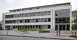 Town hall | |
 Flag  Coat of arms | |
Location of Kirchlengern within Herford district  | |
 Kirchlengern 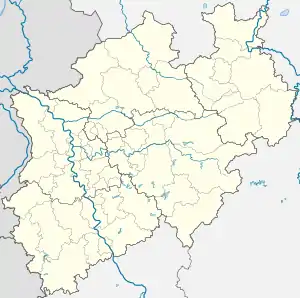 Kirchlengern | |
| Coordinates: 52°12′00″N 08°37′59″E / 52.20000°N 8.63306°E | |
| Country | Germany |
| State | North Rhine-Westphalia |
| Admin. region | Detmold |
| District | Herford |
| Subdivisions | 7 |
| Government | |
| • Mayor (2020–25) | Rüdiger Meier[1] (CDU) |
| Area | |
| • Total | 33.78 km2 (13.04 sq mi) |
| Elevation | 53 m (174 ft) |
| Population (2021-12-31)[2] | |
| • Total | 16,111 |
| • Density | 480/km2 (1,200/sq mi) |
| Time zone | UTC+01:00 (CET) |
| • Summer (DST) | UTC+02:00 (CEST) |
| Postal codes | 32278 |
| Dialling codes | 05223 (Bünde) |
| Vehicle registration | HF |
| Website | www.kirchlengern.de |
Kirchlengern is a municipality in the district of Herford, in North Rhine-Westphalia, Germany.
Geography
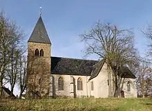
Lutheran Monastery Church of St. Mary's in Kirchlengern-Stift Quernheim
Kirchlengern is situated on the river Else, approx. 10 km north of Herford.
Neighbouring places
Division of the municipality
The municipality is divided in 7 districts:
- Häver (1,900 inhabitants)
- Kirchlengern (6,051 inhabitants)
- Klosterbauerschaft (2,568 inhabitants)
- Quernheim (1,549 inhabitants)
- Rehmerloh (203 inhabitants)
- Stift Quernheim (1,668 inhabitants)
- Südlengern (3,154 inhabitants)
Mayors
- since 2004: Rüdiger Meier (CDU)
- 1999-2004: Werner Helmke (SPD)
Notable people
- 1833–1900, Ernst Heinrich Lindemann, politician
- 1924–2003, Hellmuth Buddenberg, manager
- 1942–2017, Gunter Gabriel, singer
- 1953, Jürgen Klute, politician
- 1953, Reinhard Göhner, politician
- 1958, Elke Kruse, artist
- 1984, David Odonkor, footballer
References
- ↑ Wahlergebnisse in NRW Kommunalwahlen 2020, Land Nordrhein-Westfalen, accessed 21 June 2021.
- ↑ "Bevölkerung der Gemeinden Nordrhein-Westfalens am 31. Dezember 2021" (in German). Landesbetrieb Information und Technik NRW. Retrieved 20 June 2022.
External links
- Official website
 (in German)
Towns and municipalities in Herford (district) | ||
|---|---|---|
Coat of Arms of Herford district | ||
This article is issued from Wikipedia. The text is licensed under Creative Commons - Attribution - Sharealike. Additional terms may apply for the media files.