Kirwin | |
|---|---|
.jpg.webp) Kirwin, 1905 | |
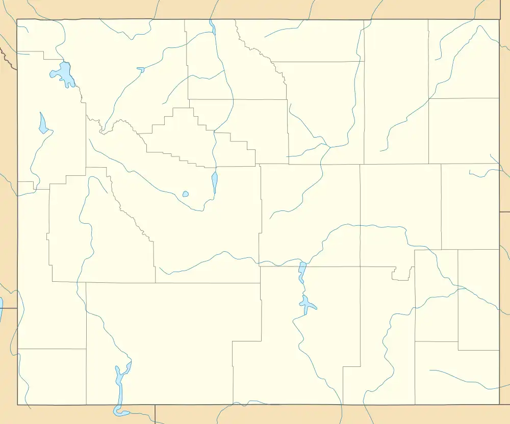
 Kirwin Location within the state of Wyoming  Kirwin Kirwin (the United States) | |
| Coordinates: 43°52′35″N 109°17′53″W / 43.87639°N 109.29806°W | |
| Country | United States |
| State | Wyoming |
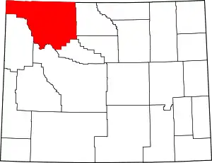
| County | Park |
| Time zone | UTC-7 (Mountain (MST)) |
| • Summer (DST) | UTC-6 (MDT) |
| GNIS feature ID | 1600733[1] |
Kirwin is an unincorporated community in Park County, in the U.S. state of Wyoming. Its post office has been closed.[2]
The former mining town is a historic site. Amelia Earhart was having a cabin built there before her disappearance.[3]
Climate
Kirwin has a subarctic climate (Köppen Dfc).
| Climate data for Kirwin, Wyoming, 1991–2020 normals: 9550ft (2911m) | |||||||||||||
|---|---|---|---|---|---|---|---|---|---|---|---|---|---|
| Month | Jan | Feb | Mar | Apr | May | Jun | Jul | Aug | Sep | Oct | Nov | Dec | Year |
| Mean daily maximum °F (°C) | 26.0 (−3.3) |
27.6 (−2.4) |
36.6 (2.6) |
43.0 (6.1) |
50.7 (10.4) |
59.7 (15.4) |
68.4 (20.2) |
66.7 (19.3) |
56.9 (13.8) |
42.5 (5.8) |
30.8 (−0.7) |
25.0 (−3.9) |
44.5 (6.9) |
| Daily mean °F (°C) | 17.7 (−7.9) |
17.9 (−7.8) |
24.9 (−3.9) |
30.6 (−0.8) |
39.2 (4.0) |
47.3 (8.5) |
54.6 (12.6) |
53.4 (11.9) |
45.3 (7.4) |
33.3 (0.7) |
22.7 (−5.2) |
17.0 (−8.3) |
33.7 (0.9) |
| Mean daily minimum °F (°C) | 9.3 (−12.6) |
7.9 (−13.4) |
12.9 (−10.6) |
18.1 (−7.7) |
27.6 (−2.4) |
34.8 (1.6) |
40.8 (4.9) |
40.0 (4.4) |
33.8 (1.0) |
23.9 (−4.5) |
14.6 (−9.7) |
8.9 (−12.8) |
22.7 (−5.1) |
| Average precipitation inches (mm) | 1.63 (41) |
1.88 (48) |
2.41 (61) |
2.97 (75) |
3.62 (92) |
2.45 (62) |
1.81 (46) |
1.69 (43) |
2.17 (55) |
2.22 (56) |
1.93 (49) |
2.01 (51) |
26.79 (679) |
| Source 1: XMACIS2[4] | |||||||||||||
| Source 2: NOAA (Precipitation)[5] | |||||||||||||
Mount Crosby (Wyoming) is a mountain that rises to the north of Kirwin. There is no weather station at the summit, but this climate table contains interpolated data for an area around the summit. Mount Crosby has an Alpine climate (ET).
| Climate data for Mount Crosby 43.8749 N, 109.3331 W, Elevation: 11,991 ft (3,655 m) (1991–2020 normals) | |||||||||||||
|---|---|---|---|---|---|---|---|---|---|---|---|---|---|
| Month | Jan | Feb | Mar | Apr | May | Jun | Jul | Aug | Sep | Oct | Nov | Dec | Year |
| Mean daily maximum °F (°C) | 18.8 (−7.3) |
18.7 (−7.4) |
24.8 (−4.0) |
31.0 (−0.6) |
39.7 (4.3) |
49.9 (9.9) |
59.5 (15.3) |
58.4 (14.7) |
49.2 (9.6) |
36.0 (2.2) |
24.4 (−4.2) |
17.9 (−7.8) |
35.7 (2.1) |
| Daily mean °F (°C) | 10.2 (−12.1) |
9.2 (−12.7) |
14.3 (−9.8) |
19.4 (−7.0) |
28.0 (−2.2) |
37.4 (3.0) |
46.0 (7.8) |
45.2 (7.3) |
37.1 (2.8) |
25.7 (−3.5) |
15.8 (−9.0) |
9.6 (−12.4) |
24.8 (−4.0) |
| Mean daily minimum °F (°C) | 1.7 (−16.8) |
−0.3 (−17.9) |
3.7 (−15.7) |
7.9 (−13.4) |
16.4 (−8.7) |
24.8 (−4.0) |
32.6 (0.3) |
32.0 (0.0) |
24.9 (−3.9) |
15.4 (−9.2) |
7.2 (−13.8) |
1.3 (−17.1) |
14.0 (−10.0) |
| Average precipitation inches (mm) | 1.80 (46) |
2.03 (52) |
2.49 (63) |
3.13 (80) |
3.84 (98) |
2.52 (64) |
2.01 (51) |
1.89 (48) |
2.33 (59) |
2.28 (58) |
2.07 (53) |
2.21 (56) |
28.6 (728) |
| Source: PRISM Climate Group[6] | |||||||||||||
Gallery
 Wolf Mine in Kirwin
References
- ↑ U.S. Geological Survey Geographic Names Information System: Kirwin, Wyoming
- ↑ U.S. Geological Survey Geographic Names Information System: Kirwin WY post office
- ↑ Freedman, Lew (July 19, 2017). "Vandalism at Kirwin site investigated". Cody Enterprise. Retrieved August 25, 2017.
- ↑ "xmACIS2". National Oceanic and Atmospheric Administration. Retrieved October 12, 2023.
- ↑ "Kirwin, Wyoming 1991-2020 Monthly Normals". Retrieved October 12, 2023.
- ↑ "PRISM Climate Group, Oregon State University". PRISM Climate Group, Oregon State University. Retrieved October 12, 2023.
To find the table data on the PRISM website, start by clicking Coordinates (under Location); copy Latitude and Longitude figures from top of table; click Zoom to location; click Precipitation, Minimum temp, Mean temp, Maximum temp; click 30-year normals, 1991-2020; click 800m; click Retrieve Time Series button.
This article is issued from Wikipedia. The text is licensed under Creative Commons - Attribution - Sharealike. Additional terms may apply for the media files.
