Klapanunggal | |
|---|---|
 Klapanunggal  Klapanunggal Klapanunggal (Java)  Klapanunggal Klapanunggal (Indonesia) | |
| Coordinates: 6°27′07″S 106°57′25″E / 6.452038°S 106.956940°E | |
| Country | |
| Province | West Java |
| Regency | Bogor Regency |
| Government | |
| • Camat | Asep Mulyana |
| Area | |
| • Total | 70.57 km2 (27.25 sq mi) |
| Elevation | 167 m (548 ft) |
| Highest elevation | 732 m (2,402 ft) |
| Lowest elevation | 81 m (266 ft) |
| Population (2020 Census) | |
| • Total | 127,561 |
| • Density | 1,372.5/km2 (3,555/sq mi) |
| Time zone | UTC+7 (IWST) |
| Area code | (+62) 251 |
| Vehicle registration | F |
| Villages | 9 |
| Website | kecamatankelapanunggal |
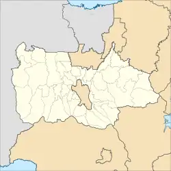
Klapanunggal or Kelapanunggal[1] is a town and district (Indonesian: Kecamatan) in the Bogor Regency, West Java, Indonesia. It is home to an industrial area that is part of a larger industrial site that also covers various districts in the same regency, including Gunung Putri and Cileungsi.
Because of the industrial area, Klapanunggal is also home to a stable balanced population between local factory/industrial workers, and commuters to the Greater Jakarta area. As a result, from having a rather large number of commuters, the town has Nambo station as a station that connects the town with the local commuter rail, KRL Jabodetabek.
Gallery
 Karst hills near Klapanunggal
References
This article is issued from Wikipedia. The text is licensed under Creative Commons - Attribution - Sharealike. Additional terms may apply for the media files.