Kraemer, Louisiana | |
|---|---|
 "Little Red Schoolhouse" of Bayou Boeuf Elementary School | |
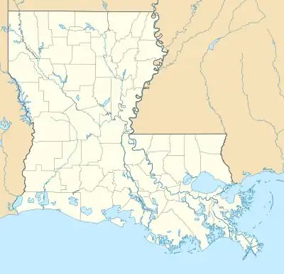 Kraemer  Kraemer | |
| Coordinates: 29°52′01″N 90°41′49″W / 29.86694°N 90.69694°W | |
| Country | United States |
| State | Louisiana |
| Parish | Lafourche |
| Area | |
| • Total | 5.32 sq mi (13.79 km2) |
| • Land | 5.25 sq mi (13.59 km2) |
| • Water | 0.08 sq mi (0.20 km2) |
| Elevation | 3 ft (0.9 m) |
| Population (2020) | |
| • Total | 877 |
| • Density | 167.08/sq mi (64.51/km2) |
| Time zone | UTC-6 (Central (CST)) |
| • Summer (DST) | UTC-5 (CDT) |
| ZIP code | 70371 |
| Area code | 985 |
| GNIS feature ID | 536230[2] |
Kraemer is a census-designated place (CDP) in Lafourche Parish, Louisiana, United States.[2] As of the 2010 census, its population was 934.[3] Its ZIP code is 70371.[4] It is also known as Bayou Boeuf.[5]
Demographics
| Census | Pop. | Note | %± |
|---|---|---|---|
| 2020 | 877 | — | |
| U.S. Decennial Census[6] | |||
Education
Lafourche Parish Public Schools operates public schools. Bayou Boeuf Elementary School, Sixth Ward Middle School, and Thibodaux High School serve the Bayou Boeuf area.[7][8]
Government and infrastructure
Residents are served by the Ward 6 Senior Citizens Center.[9]
Notes
- ↑ "2020 U.S. Gazetteer Files". United States Census Bureau. Retrieved March 20, 2022.
- 1 2 "Kraemer, Louisiana". Geographic Names Information System. United States Geological Survey, United States Department of the Interior.
- ↑ "U.S. Census website". United States Census Bureau. Retrieved May 14, 2011.
- ↑ United States Postal Service (2012). "USPS - Look Up a ZIP Code". Retrieved February 15, 2012.
- ↑ Theriot, Clifton. Lafourche Parish (Images of America). Arcadia Publishing, December 1, 2014. ISBN 1439648662, 9781439648667. p. 21.
- ↑ "Census of Population and Housing". Census.gov. Retrieved June 4, 2016.
- ↑ "SCHOOL ATTENDANCE BOUNDARIES Archived 2016-12-02 at the Wayback Machine." Lafourche Parish Public Schools. Retrieved on December 2, 2016. Based on the text description of the school boundaries
- ↑ "2010 CENSUS - CENSUS BLOCK MAP (INDEX): Kraemer CDP, LA." U.S. Census Bureau. Retrieved on February 7, 2018. Pages: 1, 2.
- ↑ Legendre, Raymond (January 9, 2009). "Senior center's walking trail has tire tracks". The Daily Comet. Archived from the original on December 1, 2015. Retrieved December 3, 2016.
{{cite news}}: CS1 maint: bot: original URL status unknown (link)
Further reading
- Cortez, Martin L. (2004). Dessus Le Bayou Boeuf: The History of Bayou Boeuf/Kraemer, Louisiana. Ann Arbor, MI: Cushing-Malloy.
Municipalities and communities of Lafourche Parish, Louisiana, United States | ||
|---|---|---|
| City |  | |
| Towns | ||
| CDPs | ||
| Other communities | ||
| Footnotes | ‡This populated place also has portions in an adjacent parish or parishes | |
This article is issued from Wikipedia. The text is licensed under Creative Commons - Attribution - Sharealike. Additional terms may apply for the media files.