Hualong
化隆县 · خُوَلْو | |
|---|---|
| 化隆回族自治县 · خُوَلْو خُوِذُو ذِجِشِیًا Hualong Hui Autonomous County | |
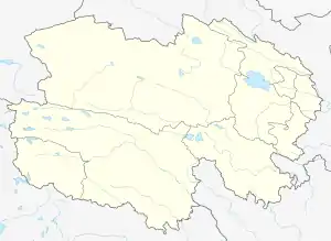
 Hualong Location of the seat in Qinghai | |
| Coordinates: 36°05′N 102°12′E / 36.083°N 102.200°E | |
| Country | China |
| Province | Qinghai |
| Prefecture-level city | Haidong |
| County seat | Bayan |
| Area | |
| • Total | 2,740 km2 (1,060 sq mi) |
| Population (2020) | |
| • Total | 200,474 |
| • Density | 73/km2 (190/sq mi) |
| Time zone | UTC+8 (China Standard) |
| Website | www |
| Hualong Hui Autonomous County | |||||||
|---|---|---|---|---|---|---|---|
| Chinese name | |||||||
| Simplified Chinese | 化隆回族自治縣 | ||||||
| Traditional Chinese | 化隆回族自治縣 | ||||||
| |||||||
| Tibetan name | |||||||
| Tibetan | བ་ཡན་ཧུའེ་རིགས་རང་སྐྱོང་རྫོང་། | ||||||
| |||||||
Hualong Hui Autonomous County (simplified Chinese: 化隆回族自治县; traditional Chinese: 化隆回族自治縣; pinyin: Huàlóng Huízú Zìzhìxiàn; Xiao'erjing: خُوَلْو خُوِذُو ذِجِشِیًا) is a county in the east of Qinghai Province, China. It is under the administration of Haidong City. Its area is 2,790 square kilometers and has a population of 203,317 in 2010.[1]
Administrative divisions
Huzhu is divided into 6 towns, 7 townships, and 4 ethnic townships.
- Bayan Town (巴燕镇, བཱ་ཡན་གྲོང་རྡལ།)
- Qunke Town (群科镇, ཚའཱི་མགུར་གྲོང་རྡལ།)
- Yashiga Town (牙什尕镇, ཡར་ག་གྲོང་རྡལ།)
- Gandu Town (甘都镇, ཀ་མདོ་གྲོང་རྡལ།)
- Zhaba Town (扎巴镇, རྩ་བ་གྲོང་རྡལ།)
- Angsiduo Town (昂思多镇, ནང་སྟོད་གྲོང་རྡལ།)
- Chuma Township (初麻乡, ཆུ་དམར་ཞང་།)
- Ertang Township (二塘乡, ཨེར་ཐང་ཞང་།)
- Xiejiatan Township (谢家滩乡)
- Dehenglong Township (德恒隆乡, སྟག་ལུང་ཞང་།)
- Shalianbao Township (沙连堡乡, ས་ལེན་པུའུ་ཞང་།)
- Ashennu Township (阿什奴乡, ཨ་སྔོན་ཞང་།)
- Shidacang Township (石大仓乡, སྟག་ཚང་ཞང་།)
- Shongshen Tibetan Ethnic Township (雄先藏族乡, གཤོང་ཤན་བོད་རིགས་ཞང་།)
- Tsaphug Tibetan Ethnic Township (查甫藏族乡, ཚ་ཕུག་བོད་རིགས་ཞང་།)
- Thagya Tibetan Ethnic Township (塔加藏族乡, ཐ་རྒྱ་བོད་རིགས་ཞང་།)
- Serzhong Tibetan Ethnic Township (金源藏族乡, གསེར་གཞོང་བོད་རིགས་ཞང་།)
Climate
| Climate data for Hualong (1991–2020 normals, extremes 1981–2010) | |||||||||||||
|---|---|---|---|---|---|---|---|---|---|---|---|---|---|
| Month | Jan | Feb | Mar | Apr | May | Jun | Jul | Aug | Sep | Oct | Nov | Dec | Year |
| Record high °C (°F) | 12.4 (54.3) |
16.6 (61.9) |
22.1 (71.8) |
28.0 (82.4) |
26.4 (79.5) |
27.7 (81.9) |
32.5 (90.5) |
29.3 (84.7) |
25.1 (77.2) |
19.8 (67.6) |
15.7 (60.3) |
12.5 (54.5) |
32.5 (90.5) |
| Mean daily maximum °C (°F) | −1.0 (30.2) |
2.1 (35.8) |
6.7 (44.1) |
12.2 (54.0) |
15.5 (59.9) |
18.5 (65.3) |
20.6 (69.1) |
19.8 (67.6) |
15.4 (59.7) |
10.4 (50.7) |
5.4 (41.7) |
0.6 (33.1) |
10.5 (50.9) |
| Daily mean °C (°F) | −9.5 (14.9) |
−6.3 (20.7) |
−1.1 (30.0) |
4.6 (40.3) |
8.8 (47.8) |
12.3 (54.1) |
14.3 (57.7) |
13.3 (55.9) |
9.2 (48.6) |
3.5 (38.3) |
−2.7 (27.1) |
−7.8 (18.0) |
3.2 (37.8) |
| Mean daily minimum °C (°F) | −15.5 (4.1) |
−12.5 (9.5) |
−6.9 (19.6) |
−1.6 (29.1) |
2.9 (37.2) |
6.7 (44.1) |
8.8 (47.8) |
8.1 (46.6) |
4.7 (40.5) |
−1.1 (30.0) |
−8.0 (17.6) |
−13.7 (7.3) |
−2.3 (27.8) |
| Record low °C (°F) | −26.8 (−16.2) |
−24.4 (−11.9) |
−20.6 (−5.1) |
−12.1 (10.2) |
−10.6 (12.9) |
−0.7 (30.7) |
0.4 (32.7) |
0.1 (32.2) |
−3.6 (25.5) |
−12.9 (8.8) |
−20.7 (−5.3) |
−27.0 (−16.6) |
−27.0 (−16.6) |
| Average precipitation mm (inches) | 2.6 (0.10) |
4.1 (0.16) |
11.2 (0.44) |
23.4 (0.92) |
60.0 (2.36) |
73.4 (2.89) |
91.9 (3.62) |
98.4 (3.87) |
68.8 (2.71) |
28.1 (1.11) |
5.3 (0.21) |
1.6 (0.06) |
468.8 (18.45) |
| Average precipitation days (≥ 0.1 mm) | 4.1 | 5.4 | 7.3 | 8.6 | 13.6 | 16.8 | 16.6 | 16.0 | 15.0 | 9.2 | 4.0 | 2.7 | 119.3 |
| Average snowy days | 5.6 | 7.6 | 9.6 | 8.2 | 3.8 | 0.2 | 0 | 0 | 0.6 | 6.1 | 5.4 | 4.2 | 51.3 |
| Average relative humidity (%) | 48 | 49 | 51 | 52 | 58 | 64 | 69 | 73 | 76 | 70 | 56 | 48 | 60 |
| Mean monthly sunshine hours | 215.0 | 202.5 | 220.8 | 226.0 | 224.3 | 210.1 | 220.3 | 212.7 | 171.1 | 197.9 | 216.5 | 221.1 | 2,538.3 |
| Percent possible sunshine | 69 | 65 | 59 | 57 | 51 | 48 | 50 | 51 | 47 | 58 | 71 | 74 | 58 |
| Source: China Meteorological Administration[2][3] | |||||||||||||
See also
References
- ↑ "Huàlóng Huízú Zìzhìxiàn (Autonomous County, China) - Population Statistics, Charts, Map and Location". www.citypopulation.de. Retrieved 2021-07-17.
- ↑ 中国气象数据网 – WeatherBk Data (in Simplified Chinese). China Meteorological Administration. Retrieved 27 August 2023.
- ↑ 中国气象数据网 (in Simplified Chinese). China Meteorological Administration. Retrieved 27 August 2023.
External links
This article is issued from Wikipedia. The text is licensed under Creative Commons - Attribution - Sharealike. Additional terms may apply for the media files.