Kuchinarai
กุฉินารายณ์ | |
|---|---|
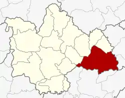 District location in Kalasin province | |
| Coordinates: 16°32′18″N 104°3′18″E / 16.53833°N 104.05500°E | |
| Country | Thailand |
| Province | Kalasin |
| Area | |
| • Total | 739.247 km2 (285.425 sq mi) |
| Population (2008) | |
| • Total | 101,184 |
| • Density | 136.3/km2 (353/sq mi) |
| Time zone | UTC+7 (ICT) |
| Postal code | 46110 |
| Geocode | 4605 |
Kuchinarai (Thai: กุฉินารายณ์, pronounced [kùʔ.t͡ɕʰìʔ.nāː.rāːj]) is a district (amphoe) in the eastern part of Kalasin province, northeastern Thailand.
Geography
Neighboring districts are (from the west clockwise): Don Chan, Na Mon, Huai Phueng, Na Khu, and Khao Wong of Kalasin Province; Khamcha-i and Nong Sung of Mukdahan province; Moei Wadi, Phon Thong, and Pho Chai of Roi Et province.
Economy
A traditional sugarcane product that used to be common in Thailand is now made only in this district, and specifically, in Lao Hai Ngam Subdistrict. It is called 'sugarcane cake' (Thai: งบอ้อย, RTGS: ngop oi) or 'sugar cake' (Thai: น้ำตาลอ้อย, RTGS: namtan oi). It is made from indigenous cane grown for more than eight months. Rice farmers produce it as a secondary money-earner. The sugar cakes are made only in February and are quickly bought up and disappear from the market until the following year.[1]
Administration
The district is divided into 12 sub-districts (tambons), which are further subdivided into 142 villages (mubans). There are two sub-district municipalities (thesaban tambon): Bua Khao and Kut Wa, each covering parts of the same-named tambon. There are a further 12 tambon administrative organizations (TAO).
| No. | Name | Thai | Villages | Pop.[2] |
|---|---|---|---|---|
| 1. | Bua Khao | บัวขาว | 16 | 20,369 |
| 2. | Chaen Laen | แจนแลน | 8 | 6,395 |
| 3. | Lao Yai | เหล่าใหญ่ | 12 | 7,338 |
| 4. | Chum Chang | จุมจัง | 15 | 9,260 |
| 5. | Lao Hai Ngam | เหล่าไฮงาม | 12 | 7,107 |
| 6. | Kut Wa | กุดหว้า | 12 | 9,802 |
| 7. | Sam Kha | สามขา | 18 | 9,793 |
| 8. | Na Kham | นาขาม | 16 | 12,564 |
| 9. | Nong Hang | หนองห้าง | 9 | 5,246 |
| 10. | Na Ko | นาโก | 9 | 4,760 |
| 11. | Som Sa-at | สมสะอาด | 7 | 4,389 |
| 12. | Kut Khao | กุดค้าว | 8 | 4,161 |
References
- ↑ Sukphisit, Suthon (21 July 2019). "Sweet Success". Bangkok Post. Retrieved 21 July 2019.
- ↑ "Population statistics 2008". Department of Provincial Administration. Archived from the original on 17 August 2009. Retrieved 11 August 2009.
External links
- amphoe.com (Thai)