La Bosse | |
|---|---|
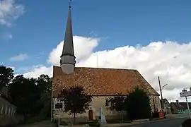 Saint James church | |
Location of La Bosse | |
 La Bosse  La Bosse | |
| Coordinates: 48°10′12″N 0°31′34″E / 48.17°N 0.526°E | |
| Country | France |
| Region | Pays de la Loire |
| Department | Sarthe |
| Arrondissement | Mamers |
| Canton | La Ferté-Bernard |
| Government | |
| • Mayor (2020–2026) | Raymond Bellencontre[1] |
| Area 1 | 10.85 km2 (4.19 sq mi) |
| Population | 146 |
| • Density | 13/km2 (35/sq mi) |
| Time zone | UTC+01:00 (CET) |
| • Summer (DST) | UTC+02:00 (CEST) |
| INSEE/Postal code | 72040 /72400 |
| 1 French Land Register data, which excludes lakes, ponds, glaciers > 1 km2 (0.386 sq mi or 247 acres) and river estuaries. | |
La Bosse (French pronunciation: [la bɔs]) is a commune in the Sarthe department in the region of Pays de la Loire in north-western France.
Population
| Year | Pop. | ±% p.a. |
|---|---|---|
| 1968 | 215 | — |
| 1975 | 201 | −0.96% |
| 1982 | 163 | −2.95% |
| 1990 | 141 | −1.80% |
| 1999 | 111 | −2.62% |
| 2007 | 125 | +1.50% |
| 2012 | 115 | −1.65% |
| 2017 | 137 | +3.56% |
| Source: INSEE[3] | ||
See also
References
- ↑ "Répertoire national des élus: les maires" (in French). data.gouv.fr, Plateforme ouverte des données publiques françaises. 13 September 2022.
- ↑ "Populations légales 2021". The National Institute of Statistics and Economic Studies. 28 December 2023.
- ↑ Population en historique depuis 1968, INSEE
Wikimedia Commons has media related to La Bosse (Sarthe).
This article is issued from Wikipedia. The text is licensed under Creative Commons - Attribution - Sharealike. Additional terms may apply for the media files.