La Chapelle-Gaudin | |
|---|---|
Part of Argentonnay | |
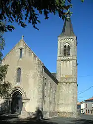 The church in La Chapelle-Gaudin | |
Location of La Chapelle-Gaudin | |
 La Chapelle-Gaudin  La Chapelle-Gaudin | |
| Coordinates: 46°55′56″N 0°22′50″W / 46.9322°N 0.3806°W | |
| Country | France |
| Region | Nouvelle-Aquitaine |
| Department | Deux-Sèvres |
| Arrondissement | Bressuire |
| Canton | Saint-Varent |
| Commune | Argentonnay |
| Area 1 | 17.01 km2 (6.57 sq mi) |
| Population (2019)[1] | 269 |
| • Density | 16/km2 (41/sq mi) |
| Time zone | UTC+01:00 (CET) |
| • Summer (DST) | UTC+02:00 (CEST) |
| Postal code | 79300 |
| Elevation | 101–166 m (331–545 ft) (avg. 1,600 m or 5,200 ft) |
| 1 French Land Register data, which excludes lakes, ponds, glaciers > 1 km2 (0.386 sq mi or 247 acres) and river estuaries. | |
La Chapelle-Gaudin (French pronunciation: [la ʃapɛl ɡodɛ̃]) is a former commune in the Deux-Sèvres department in western France. On 1 January 2016, it was merged into the new commune Argentonnay.[2]
See also
References
- ↑ Téléchargement du fichier d'ensemble des populations légales en 2019, INSEE
- ↑ Arrêté préfectoral 17 November 2015 (in French)
Wikimedia Commons has media related to La Chapelle-Gaudin.
This article is issued from Wikipedia. The text is licensed under Creative Commons - Attribution - Sharealike. Additional terms may apply for the media files.