Lac-Duparquet | |
|---|---|
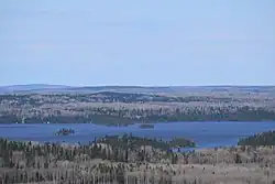 Lake Hebecourt | |
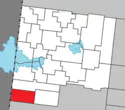 Location within Abitibi-Ouest RCM | |
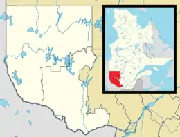 Lac-Duparquet Location in western Quebec | |
| Coordinates: 48°28′N 79°25′W / 48.467°N 79.417°W | |
| Country | Canada |
| Province | Quebec |
| Region | Abitibi-Témiscamingue |
| RCM | Abitibi-Ouest |
| Constituted | n/a |
| Government | |
| • Federal riding | Abitibi—Témiscamingue |
| • Prov. riding | Abitibi-Ouest |
| Area | |
| • Total | 130.78 km2 (50.49 sq mi) |
| • Land | 113.66 km2 (43.88 sq mi) |
| Population (2021)[2] | |
| • Total | 0 |
| • Density | 0.0/km2 (0/sq mi) |
| • Pop (2016-21) | |
| • Dwellings | 0 |
| Time zone | UTC−05:00 (EST) |
| • Summer (DST) | UTC−04:00 (EDT) |
| Highways | No major routes |
Lac-Duparquet is an unorganized territory in the Abitibi-Témiscamingue region of Quebec, Canada. It is one of two unorganized territories in the Abitibi-Ouest Regional County Municipality but the only one without a permanent population. It is located between the namesake Lake Duparquet and the Quebec/Ontario border.[3]
Demographics
Population:
- Population in 2021: 0
- Population in 2016: 0
- Population in 2011: 0
- Population in 2006: 0
- Population in 2001: 0
References
- 1 2 "Répertoire des municipalités: Geographic code 87902". www.mamh.gouv.qc.ca (in French). Ministère des Affaires municipales et de l'Habitation.
- 1 2 "Lac-Duparquet (Code 2487902) Census Profile". 2021 census. Government of Canada - Statistics Canada.
- ↑ "Banque de noms de lieux du Québec: Reference number 149738". toponymie.gouv.qc.ca (in French). Commission de toponymie du Québec.
External links
![]() Media related to Lac-Duparquet at Wikimedia Commons
Media related to Lac-Duparquet at Wikimedia Commons
Adjacent Municipal Subdivisions | ||||||||||||||||
|---|---|---|---|---|---|---|---|---|---|---|---|---|---|---|---|---|
| ||||||||||||||||
| Towns | |
|---|---|
| Municipalities | |
| Townships | |
| Parishes | |
| Unorganized territories | |
| |
This article is issued from Wikipedia. The text is licensed under Creative Commons - Attribution - Sharealike. Additional terms may apply for the media files.