Lafayette Township | |
|---|---|
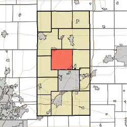 Location in Madison County | |
| Coordinates: 40°10′43″N 85°43′46″W / 40.17861°N 85.72944°W | |
| Country | |
| State | |
| County | Madison |
| Government | |
| • Type | Indiana township |
| Area | |
| • Total | 35.29 sq mi (91.4 km2) |
| • Land | 35.29 sq mi (91.4 km2) |
| • Water | 0 sq mi (0 km2) 0% |
| Elevation | 873 ft (266 m) |
| Population (2010) | |
| • Total | 5,275 |
| • Density | 149.5/sq mi (57.7/km2) |
| ZIP codes | 46001, 46011, 46012, 46044 |
| GNIS feature ID | 0453532 |
Lafayette Township is one of fourteen townships in Madison County, Indiana, United States. As of the 2010 census, its population was 5,275 and it contained 2,379 housing units.[1]
Lafayette Township was organized in 1836.[2]
Geography
According to the 2010 census, the township has a total area of 35.29 square miles (91.4 km2), all land.[1]
Cities, towns, villages
Unincorporated towns
- Florida at 40°09′37″N 85°42′37″W / 40.160319°N 85.710254°W
- Linwood at 40°11′37″N 85°40′54″W / 40.193652°N 85.681643°W
- North Anderson at 40°08′07″N 85°40′41″W / 40.135319°N 85.678032°W
- Prosperity at 40°10′45″N 85°40′19″W / 40.179208°N 85.671920°W
(This list is based on USGS data and may include former settlements.)
Cemeteries
The township contains Independent Order of Odd Fellows Cemetery.
Major highways
Airports and landing strips
- H and R Skylane Airport
Education
- Anderson Community School Corporation
- Frankton-Lapel Community Schools
Lafayette Township residents may obtain a free library card from the North Madison County Public Library System with branches in Elwood, Frankton, and Summitville.[3]
Political districts
- Indiana's 6th congressional district
- State House District 36
- State Senate District 25
References
- "Lafayette Township, Madison County, Indiana". Geographic Names Information System. United States Geological Survey, United States Department of the Interior. Retrieved October 3, 2009.
- United States Census Bureau 2008 TIGER/Line Shapefiles
- IndianaMap
- 1 2 "Population, Housing Units, Area, and Density: 2010 - County -- County Subdivision and Place -- 2010 Census Summary File 1". United States Census. Archived from the original on February 12, 2020. Retrieved May 10, 2013.
- ↑ Forkner, John La Rue; Dyson, Byron H. (1897). Historical Sketches and Reminiscences of Madison County, Indiana. Wilson, Humprheys & Co. p. 812.
- ↑ "Policies" (PDF). North Madison County Public Library System. Retrieved March 10, 2018.
External links
- Indiana Township Association Archived 2020-04-14 at the Wayback Machine
- United Township Association of Indiana
- City-Data.com page for Lafayette Township
- Lafayette Township history
Places adjacent to Lafayette Township, Madison County, Indiana | ||||||||||||||||
|---|---|---|---|---|---|---|---|---|---|---|---|---|---|---|---|---|
| ||||||||||||||||
Municipalities and communities of Madison County, Indiana, United States | ||
|---|---|---|
| Cities | Map of Indiana highlighting Madison County | |
| Towns | ||
| Townships | ||
| CDPs | ||
| Other communities | ||
| Footnotes | ‡This populated place also has portions in an adjacent county or counties | |
This article is issued from Wikipedia. The text is licensed under Creative Commons - Attribution - Sharealike. Additional terms may apply for the media files.