Lafitte, Louisiana | |
|---|---|
Census-designated place | |
 Voleo's Seafood restaurant in Lafitte | |
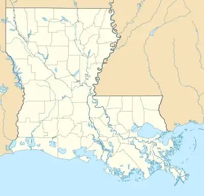
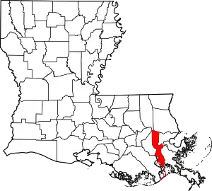
 Lafitte, Louisiana Location of Lafitte in Louisiana | |
| Coordinates: 29°40′39″N 90°06′19″W / 29.67750°N 90.10528°W | |
| Country | United States |
| State | Louisiana |
| Parish | Jefferson |
| Area | |
| • Total | 6.41 sq mi (16.60 km2) |
| • Land | 4.84 sq mi (12.54 km2) |
| • Water | 1.57 sq mi (4.06 km2) |
| Population (2020) | |
| • Total | 1,014 |
| • Density | 209.46/sq mi (80.88/km2) |
| Time zone | UTC-6 (CST) |
| • Summer (DST) | UTC-5 (CDT) |
| ZIP Code | 70067 |
| Area code | 504 |
| FIPS code | 22-40840 |
Lafitte is an unincorporated community and census-designated place (CDP) in Jefferson Parish, Louisiana, United States. The population was 972 at the 2010 census,[2] and 816 in 2019.[3] In 2020, its population increased to 1,014 people.[4] It is part of the New Orleans–Metairie–Kenner metropolitan statistical area. Lafitte is located at the southern end of Louisiana Highway 45 along Bayou Barataria,[5] and fishing is a major part of the local economy and culture.
Geography
Lafitte is located at 29°40′39″N 90°6′19″W / 29.67750°N 90.10528°W (29.677566, -90.105386).[2] It is 27 miles (43 km) by road south of New Orleans. Lafitte is bordered to the north by the town of Jean Lafitte, and to the west, across Bayou Barataria, by unincorporated Barataria. According to the United States Census Bureau, the Lafitte CDP has a total area of 6.4 square miles (16.6 km2), of which 4.8 square miles (12.5 km2) are land and 1.6 square miles (4.1 km2), or 24.57%, are water.[6]
Demographics
| Census | Pop. | Note | %± |
|---|---|---|---|
| 2020 | 1,014 | — | |
| U.S. Decennial Census[7] | |||

| Race | Number | Percentage |
|---|---|---|
| White (non-Hispanic) | 820 | 80.87% |
| Black or African American (non-Hispanic) | 8 | 0.79% |
| Native American | 18 | 1.78% |
| Asian | 16 | 1.58% |
| Other/Mixed | 93 | 9.17% |
| Hispanic or Latino | 59 | 5.82% |
The 2019 American Community Survey estimated 816 people lived in the CDP, down from 972 at the 2010 U.S. census.[3] At the 2020 United States census, there were 1,014 people, 316 households, and 222 families residing in the CDP, up from the 2019 census estimates.[4] In 2019, the racial and ethnic makeup was 89% non-Hispanic white, and 11% two or more races; the 2020 census determined 80.87% of the population was non-Hispanic white, 0.79% Black or African American, 1.78% Native American, 1.58% Asian, 9.17% two or more races, and 5.82% Hispanic or Latino American of any race;[4] this has been in contrast to its once predominantly non-Hispanic white population as the U.S. diversifies overall.[8] According to the 2019 estimates, the median household income was $58,375 and 19.2% lived at or below the poverty line.
Education
Lafitte residents are zoned to Jefferson Parish Public Schools.
Residents in K–6 are zoned to Lafitte Elementary School. Grades 7–12 are zoned to Fisher Middle-High School.
References
- ↑ "2020 U.S. Gazetteer Files". United States Census Bureau. Retrieved March 20, 2022.
- 1 2 "US Gazetteer files: 2010, 2000, and 1990". United States Census Bureau. February 12, 2011. Retrieved April 23, 2011.
- 1 2 "Geography Profile: Lafitte CDP, Louisiana". data.census.gov. Retrieved August 12, 2021.
- 1 2 3 4 "2020 Race and Population Totals". data.census.gov. Retrieved December 28, 2021.
- ↑ Sack, Kevin (February 24, 2018). "Left to Louisiana's Tides, a Village Fights for Time". The New York Times. ISSN 0362-4331. Retrieved February 24, 2018.
- ↑ "Geographic Identifiers: 2010 Census Summary File 1 (G001): Lafitte CDP, Louisiana". American Factfinder. U.S. Census Bureau. Archived from the original on February 13, 2020. Retrieved July 3, 2018.
- ↑ "Census of Population and Housing". Census.gov. Retrieved June 4, 2016.
- ↑ "America is becoming more urban, more diverse and less white, 2020 Census reveals". PBS NewsHour. August 12, 2021. Retrieved January 5, 2022.
