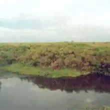
| Lake Nakuwa Wetland System | |
|---|---|
 Lake Nakuwa Wetland | |
| Location | Kamuli, Soroti and Pallisa district |
| Coordinates | 1°15′N 33°31′E / 1.250°N 33.517°E |
Lake Nakuwa Wetland System is a wetland found in Kamuli District, Pallisa District and Soroti District in Eastern Uganda. The wetland is located 25 kilometres (16 mi) from Pallisa town.[1][2]
It is associated with a number of satellite lakes and a swamp system containing papyrus which is used for making mats, thatching, and crafts as well as cichlid species and fish taxa.[3] The wetland plays a role in flood prevention and water purification, as well as ground-water recharge.[4] It is also used for bird watching.[5]
Location and structure
Lake Nakuwa Wetland System is located in the districts of Kamuli (Kagulu, Nawaikoke, Bumanya, Gudumire, and Namwiwa sub-counties), Pallisa (Gogonyo, Apopong, Buseta, and Pallisa sub-counties),[1] and Soroti (Pingire and Kateta sub-counties) in Eastern Uganda, East Africa.[4] It is situated at latitude 01° 15′ and longitude 33° 31′.[4]
See also
References
- 1 2 "Lake Nakuwa | Uganda Birding Safaris". Africa Safaris | Shanrod Africa. Retrieved 2023-06-12.
- ↑ admin (2018-10-24). "Ramsar Sites In Uganda - Important Bird Areas in Uganda | Uganda Safaris". Retrieved 2023-06-12.
- ↑ "Ramsar Sites in Uganda - Kagera Safaris". 2023-02-25. Retrieved 2023-06-12.
- 1 2 3 "Lake Nakuwa Wetland System | Ramsar Sites Information Service". rsis.ramsar.org. Retrieved 2023-06-12.
- ↑ "Ramsar Sites in Uganda - Where to Go Birding | Uganda Bird Guides". 2017-10-19. Retrieved 2023-06-12.