| Lake Poerua | |
|---|---|
| Pouerua (Māori) | |
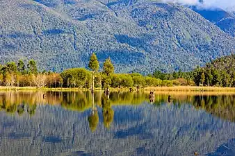
 Willow and kahikatea reflections at Lake Poerua | |
 Lake Poerua | |
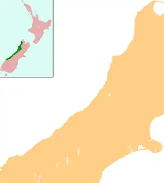
| Location | West Coast region, South Island |
| Coordinates | 42°42′S 171°30′E / 42.700°S 171.500°E |
| Primary outflows | Poerua River |
| Basin countries | New Zealand |
| Surface area | 212.7 hectares (526 acres) |
| Max. depth | 6.9 metres (23 ft) |
| Surface elevation | 125 metres (410 ft) |
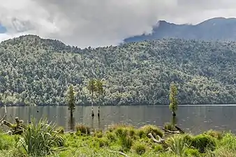
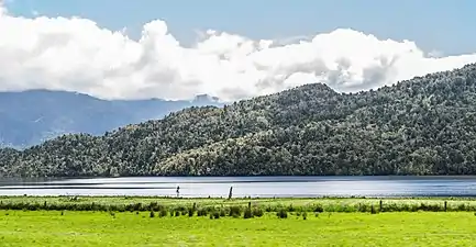
Lake Poerua (Māori: Pouerua) is a shallow lake located in the West Coast region of New Zealand's South Island roughly 13 km southeast from Lake Brunner. It is located between the Alexander Range and the slopes of Mount Te Kinga, to the north of the lake. The area around Lake Poerua is sparsely populated. A number of small streams flow into the lake, and the Poerua River flows from the lake into the Crooked River, which leads to Lake Brunner.[1]
The first description of the lake by Europeans comes from the journeys of Julius von Haast, who explored the West Coast region in the 1860s. The lake is bounded on its eastern side by the main fault scarp of the Alpine Fault, and is believed to be very recent in geological age. Lake Poerua sits on the Australia-Pacific plate boundary, with granite rock from the Australian plate to the west and metasedimentary rocks from the Pacific plate to the east.[2]
The lake is popular with trout fishermen and is easily accessible from the adjacent road. The lake has submerged or partly submerged tree stumps and large granite boulders at or below the waterline that can present a hazard for boating.[3]
The lake is just to the north of the settlement of Inchbonnie, and Lake Brunner Road (linking State Highways 7 and 73) and the Midland Line railway run along the eastern shore of the lake.[4]
The lake and surrounding area has been a popular place for visitors and picnics.[5][6]
A wetland on the shores of the north end of Lake Poerua has been identified in a schedule of Significant Wetlands of the West Coast Region, published by Westland Regional Council.[7]
- Lake Poerua impressions


References
- ↑ "Lake Poerua - West Coast New Zealand". www.fly-fishing-guides-new-zealand.co.nz. Archived from the original on 26 January 2022. Retrieved 13 July 2022.
- ↑ R. M. Langridge; R. Basili; L. Basher; A. P. Wells (26 June 2012). "Late Holocene landscape change history related to the Alpine Fault determined from drowned forests in Lake Poerua, Westland, New Zealand". Natural Hazards and Earth System Sciences. 12 (6): 2051–2064. doi:10.5194/NHESS-12-2051-2012. ISSN 1561-8633. Wikidata Q60712263.
- ↑ "Accident Report - fatality - unnamed Canadian canoe - 23 May 2008" (PDF). Maritime New Zealand. 2008. Archived (PDF) from the original on 16 February 2022. Retrieved 13 July 2022.
- ↑ "NZ Topo maps online". Archived from the original on 15 July 2022. Retrieved 13 July 2022.
- ↑ "Poerua - an ideal picnic resort". Greymouth Evening Star. 17 January 1912. Archived from the original on 15 July 2022. Retrieved 13 July 2022 – via Papers Past.
- ↑ "Combined schools picnic - the beauties of Poerua". Greymouth Evening Star. 12 February 1912. Archived from the original on 15 July 2022. Retrieved 13 July 2022 – via Papers Past.
- ↑ "Regional Plans - Land and Water Plan" (PDF). Westland Regional Council. Archived (PDF) from the original on 23 February 2022. Retrieved 13 July 2022.
External links
![]() Media related to Lake Poerua at Wikimedia Commons
Media related to Lake Poerua at Wikimedia Commons