| Lake Rotopounamu | |
|---|---|
 Lake Rotopounamu | |
 Lake Rotopounamu | |
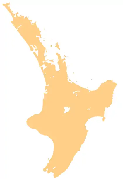
| Location | Tongariro National Park, North Island |
| Coordinates | 39°01′36″S 175°44′18″E / 39.0267°S 175.7382°E |
| Type | landslide formation |
| Primary inflows | seven streams |
| Primary outflows | Nothing visible but has a gurgler (drain) |
| Basin countries | New Zealand |
| Max. length | 1,265 m (4,150 ft) |
| Max. width | 1,025 m (3,363 ft) |
| Surface area | 1 km2 (0.39 sq mi) |
| Max. depth | 9 m (30 ft) |
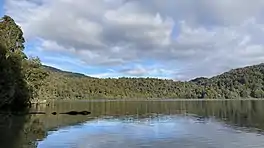
Lake Rotopounamu (also known as Greenstone Lake, from the Māori roto (lake) and pounamu (greenstone)[1]) is a secluded lake in the Pihanga Scenic Reserve, in the Tongariro National Park in New Zealand's Central North Island.[2] It lies at the northwest foot of Mt Pihanga, and was formed by a landslide around 10,000 years ago.[1] The lake is fed by seven streams, but has no visible surface outflow. It is believed to drain underground.[1]
Recreation
Around the lake is a scenic 5-kilometre (3 mi) loop track, which can be accessed from the Pihanga Saddle road (State Highway 47) between Tūrangi and Tongariro. Walking this track takes about two hours.
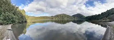
Panorama of Lake Rotopounamu from Ten Minute Beach
References
- 1 2 3 "Rotopounamu Track". Department of Conservation. Retrieved 23 August 2020.
- ↑ "Place name detail: Lake Rotopounamu". New Zealand Gazetteer. New Zealand Geographic Board. Retrieved 25 July 2020.
This article is issued from Wikipedia. The text is licensed under Creative Commons - Attribution - Sharealike. Additional terms may apply for the media files.