| Lake Traverse | |
|---|---|
 The continental divide of Lake Traverse | |
 Lake Traverse 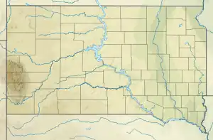 Lake Traverse  Lake Traverse | |
| Location | Traverse County, Minnesota / Roberts County, South Dakota, United States |
| Coordinates | 45°46′09″N 96°38′20″W / 45.76917°N 96.63889°W |
| Primary inflows | Mustinka River |
| Primary outflows | Bois de Sioux River |
| Basin countries | United States |
| Surface elevation | 976 ft (297 m) |
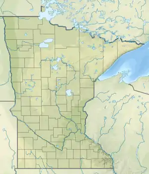
Lake Traverse is the southernmost body of water in the Hudson Bay watershed of North America. It lies along the border between the U.S. states of Minnesota and South Dakota. A low continental divide, part of the Laurentian Divide, separates the land at the southern shore of Lake Traverse from Big Stone Lake, the headwaters of the south-flowing Little Minnesota River, which is part of the Mississippi River System. Both lakes lie within a mile of the town of Browns Valley, Minnesota with Wheaton, Minnesota (at the north end of Lake Traverse); and Ortonville, Minnesota (at the south end of Big Stone Lake).
Lake Traverse is an Anglicization of Lac Traverse, a French name meaning "across the lake".[1]
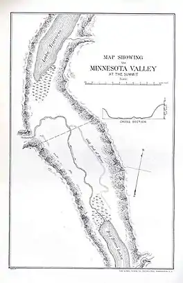
Prehistorically, the south end of Lake Traverse was the southern outlet of glacial Lake Agassiz across the Traverse Gap into Glacial River Warren; that river carved the valley now occupied by the present-day Minnesota River.
Lake Traverse is drained at its north end by the northward-flowing Bois de Sioux River, a tributary of the Red River of the North. A U.S. Army Corps of Engineers dam at the outflow regulates the lake's level. The Mustinka River flows into the lake just above the dam.
See also
External links
References
- ↑ Gannett, Henry (1905). The Origin of Certain Place Names in the United States. Government Printing Office. pp. 178.