Lamandau Regency
Kabupaten Lamandau | |
|---|---|
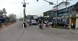 A street in Nanga Bulik, Lamandau Regency | |
 Coat of arms | |
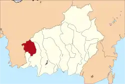 Location within Central Kalimantan | |
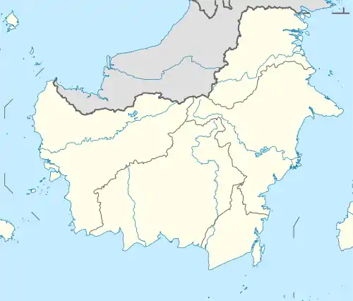 Lamandau Regency Location in Kalimantan and Indonesia  Lamandau Regency Lamandau Regency (Indonesia) | |
| Coordinates: 1°50′18″S 111°17′13″E / 1.8383°S 111.2869°E | |
| Country | Indonesia |
| Province | Central Kalimantan |
| Regency seat | Nanga Bulik |
| Government | |
| • Regent | Hendra Lesmana |
| • Vice Regent | Riko Porwanto |
| Area | |
| • Total | 2,476 sq mi (6,414 km2) |
| Population (mid 2022 estimate)[1] | |
| • Total | 104,387 |
| • Density | 42/sq mi (16/km2) |
| Time zone | UTC+7 (Western Indonesia Time) |
| Area code | (+62) 532 |
| HDI (2022) | |
| Website | lamandaukab |
Lamandau Regency (Indonesian: Kabupaten Lamandau) is a regency of Central Kalimantan province of Indonesia. The regency was created in 2002 from the northwestern parts of West Kotawaringin Regency. The regency has population of 63,119 according to 2010 census and 97,611 based on 2020 census. Population estimate at mid-2022 was 104,387.[2][3] The regency covers an area of 7,673.56 square kilometers and divided into eight districts (kecamatan). The regency seat is located at the town of Nanga Bulik, which is the regency's economic and administrative center.[3]
History
The region that is today part of Lamandau Regency centered around the town of Nanga Bulik was part of Kotawaringin Kingdom in the early 20th century. In 1920, the area was given status as onderdistrict Nanga Bulik which becomes kecamatan (district) of Nanga Bulik by the time of Indonesian independence. In 1952, it became Kewedanaan of Nanga Bulik which under it has two districts, North Kotawaringin and East Kotawarinign. The administrative order was dissolved in 1974 and the region was governed as three districts of Lamandau, Bulik, and Delang, under an administrative region (wilayah administratif) led by pembantu bupati (regent's assistant) under West Kotawaringin Regency.[4]
Following fall of Suharto and rapid decentralization that follows, several figures and groups within the region started to propose formation of a separate regency that includes the three districts of Lamandau, Bulik, and Delang. This aspiration started in a meeting on the West Kotawaringin's office on 10 November 1999, where the West Kotawaringin Regency's area were proposed to be divided to make creation of Sukamara Regency and Lamandau Regency.[5] Formerly, these districts were proposed to be part of Sukamara Regency. However, this was met with protest by the three districts who instead demanded their own regency separate from Sukamara. Followed by Law Number 5 of 2002, the regency was officially formed and inaugurated on 2 July 2002.[5] The original three districts was later divided into total eight districts on 1 August 2005 based on Regional Law Number 5 of 2005.[6]
Geography
Lamandau Regency borders Ketapang Regency and Seruyan Regency in the north and the west, West Kotawaringin Regency in the east and the south, and Sukamara Regency in the south. The regency is dominated by lowland swamps with rivers and streams around it. Soil composition of the regency consist of podzols and latosol soil which has poor water retention and absorption but relatively resilient against erosion. Underground water sources can be found within 10 to 15 meters underground. The biggest river in the regency is Lamandau river which branches into other smaller streams such as Bulik river, Belantikan river, and Matu river.[7]
Climate
Nanga Bulik, which is the capital of the regency, has a tropical rainforest climate (Af) with heavy rainfall year-round.
| Climate data for Nanga Bulik | |||||||||||||
|---|---|---|---|---|---|---|---|---|---|---|---|---|---|
| Month | Jan | Feb | Mar | Apr | May | Jun | Jul | Aug | Sep | Oct | Nov | Dec | Year |
| Mean daily maximum °C (°F) | 29.7 (85.5) |
30.1 (86.2) |
30.5 (86.9) |
31.1 (88.0) |
31.3 (88.3) |
31.1 (88.0) |
31.5 (88.7) |
31.7 (89.1) |
31.8 (89.2) |
31.5 (88.7) |
30.8 (87.4) |
30.2 (86.4) |
30.9 (87.7) |
| Daily mean °C (°F) | 26.1 (79.0) |
26.4 (79.5) |
26.5 (79.7) |
27.0 (80.6) |
27.1 (80.8) |
26.8 (80.2) |
26.9 (80.4) |
27.0 (80.6) |
27.1 (80.8) |
26.9 (80.4) |
26.7 (80.1) |
26.3 (79.3) |
26.7 (80.1) |
| Mean daily minimum °C (°F) | 22.5 (72.5) |
22.7 (72.9) |
22.6 (72.7) |
22.9 (73.2) |
23.0 (73.4) |
22.6 (72.7) |
22.4 (72.3) |
22.4 (72.3) |
22.5 (72.5) |
22.4 (72.3) |
22.6 (72.7) |
22.5 (72.5) |
22.6 (72.7) |
| Average rainfall mm (inches) | 250 (9.8) |
241 (9.5) |
284 (11.2) |
294 (11.6) |
251 (9.9) |
198 (7.8) |
159 (6.3) |
144 (5.7) |
197 (7.8) |
252 (9.9) |
302 (11.9) |
307 (12.1) |
2,879 (113.5) |
| Source: Climate-Data.org[8] | |||||||||||||
Governance
Administrative districs
Lamandau Regency consists of eight districts (kecamatan), tabulated below with their population totals from 2010 and 2020 census, together with their official population estimates on mid-2022.[6] The table also includes the number of villages in each districts, their administrative centres, as well as the post codes. The total numbers of villages in the regency is 85 rural desa and 3 urban kelurahan.[2][3]
| Kode
Wilayah |
District
(kecamatan) |
Area
in km2 |
Population
census 2010 |
Population
census 2020 |
Population
estimate mid-2022 |
Administrative
Centre |
No.
of villages |
Post
codes |
|---|---|---|---|---|---|---|---|---|
| 62.09.03 | Bulik | 665.55 | 21,989 | 38,041 | 41,496 | Nanga Bulik (a) | 14 | 74162 (b) |
| 62.09.06 | Sematu Jaya | 86.85 | 8,715 | 12,920 | 13,679 | Purwareja | 8 | 74165 |
| 62.09.05 | Menthobi Raya | 620.88 | 8,982 | 11,860 | 12,281 | Melata | 11 | 74164 |
| 62.09.04 | East Bulik | 1,074.72 | 6,467 | 9,380 | 9,883 | Merambang | 12 | 74163 |
| 62.09.01 | Lamandau | 1,333.00 | 5,454 | 9,370 | 10,211 | Tapin Bini (a) | 11 | 74660 |
| 62.09.07 | Belantikan Raya | 1,263.00 | 4,321 | 7,580 | 8,288 | Bayat | 12 | 74663 |
| 62.09.02 | Delang | 685.00 | 4,866 | 5,760 | 5,839 | Kudangan (a) | 11 | 74665 |
| 62.09.08 | Batangkawa | 685.00 | 2,405 | 2,700 | 2,710 | Kinipan | 9 | 74664 |
| Totals | '7,673.56 | 63,199 | 97,611 | 104,387 | Nanga Bulik | 88 |
Notes: (a) This district centre is classed as a kelurahan. (b) Except the town of Nanga Bulik (with a post code of 74611) and the village of Kujan (with a post code of 74612).
Economy
The dominant economic sector of the regency is agriculture, which comprises 32.09% of the regency's gross regional product as of 2022. This is followed by the processing industry, which comprises 15.01%; the mining sector, with 13.27%; and construction, with 10.80%. The total value of the regency's gross regional product as of 2022 was 4.225 trillion rupiah. Annual economic growth in the same year was 6.45%, which shows signs of recovery from previous decline during the COVID-19 pandemic. The fastest growing industry in the regency was the processing industry, with a growth of 13.13%, followed by the telecommunication sector with growth of 10.01%.[9]
Agriculture and fishery

The regency is among the largest contributor to agriculture in the Central Kalimantan province. Two main commodities from the regency are palm oil and rubber. In 2022, the regency had a total area of palm oil plantation of 24,926 hectares and produced 110,294.78 tonnes during the same year.[9] Meanwhile, rubber plantation totaled an area of 7,098 hectares and produced 1,331.040 tonnes also within 2022.[9] The agriculture sector also supports other sector of the regency, mainly processing industry which consist mostly of palm oil refineries and processing centres.[10][9] The size and economic output of these two commodities dwarfs other plantation-based commodities in the regency which only accounts for less than 1% of its agricultural output.[9] Other agricultural commodities grown in the regency is rice. However, in recent years, rice output has been declining from 4,016 tonnes in 2021 to only 530 tonnes in 2022. The area used for rice farming is also declining between 2021 and 2022 with decrease of 77.77% from 1,669 hectares to only 371 hectares. Rice as a commodity has largely fallen out of favour by land owners in the regency and in turn focused more on palm oil and rubber.[9] This shift also increased amount of land conflicts between smaller farmers and large palm oil companies, while also caused massive deforestation within the regency.[11][12]
Fishery in the regency consist of inland aquaculture due to its location which is landlocked. In 2022 there were 549 aquaculture sites which produces 689 tonnes of fish in 2022.[3] Fish cages where fish are kept and raised can be found along the Lamandau river.[13] However, scaling up the fishery sector has been proven difficult due to expensive price of fish pellets and procurement of fish seeds.[14]
Trade
Trade consist of 9.12% of the regency's economy as of 2022. Number of registered trading facilities such as shops and market buildings increased annually since 2019 with figures reaching 2,541 facilities as of 2022. From this figure, 48.72% of these facilities are warung, small shops owned usually by families. The highest number of large trade facilities are concentrated in Bulik district with 7 marketplaces. In total, the regency has 16 marketplace buildings registered, which was actually a slight decrease from 2021 with 17 register marketplace buildings. During the same year, there are 657 registered wholesale traders in the regency, followed by 630 medium-scale traders, and 1,503 small trader business registered. In addition, the regency has 231 registered restaurant business.[3]
Tourism
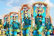
The number of tourists visiting the regency has been fluctuating since 2016, with an increase of over 25,000 tourists recorded in 2022. The number of visiting tourists decreased drastically as much as 85% between 2019 and 2020 before bouncing back after. This decrease happened due to the COVID-19 pandemic, which affected the tourism sector in Indonesia, including in Lamandau Regency. The exact figures of recorded tourists in 2022 was 50,132 visitors, which was around twice as much as the figures of 2021 with 25,359 visitors. Almost all visitors are domestic, with very little international tourist presence.[3] Accommodation in the regency includes 13 hotels and 8 registered homestays, as well as 52 noted tourist destinations such as waterfalls, rivers, and traditional villages.[9]
Demographics
The regency has expansive population pyramid with demographic dominated by those with age between 30 and 34 years old in 2022. Individuals within productive age between 15 and 64 years old comprised 71.39% of the regency's population during the same year which was a slight increase from the last year. Total workforce population recorded by Statistics Indonesia in 2022 was 45,235 while the amount of unemployed were 1,541 or around 3.41%. Among those aged between 7 and 12 years old, the school enrollment rate was 99.44%, while between 13 and 15 years old, the rate was slightly lower with 97.41%, and expected years of schooling in the regency was 12.51 years.[9] The literacy rate for those above 15 years old in the regency as of 2022 was 99.36%.[3]
Majority of the regency's population are Muslims with amount of 62,354 people in 2022, followed by Protestants at 24,524, Catholics at 16,917, Hindu at 3,227, Buddhist at 66, and 3 at other religions.[3] In 2021, there were recorded 12 different ethnicities or tribes in the regency according to the provincial government.[15] The culture of the regency is dominated by those of the Dayak tribes.[16]
Infrastucture
Education
The educational infrastructure in the regency is concentrated in Bulik district where the capital of the regency is located. The district has most amount of schools with 27 elementary schools, 9 junior highschools, and 3 senior highschools, in addition of 2 vocational highschools. District with the least amount of educational infrastructure as of 2022 is Sematu Jaya district with only 8 elementary schools, 4 junior highschools, and 1 senior highschool, in addition to only one vocational highschool. Total schools in the regency are 82 kindergartens, 118 elementary schools, 46 junior highschools, 12 senior highschools, and 10 vocational highschools. There's only one tertiary educational institution in the regency, Lamandau Polytechnic which is private and located in the regency's capital, Nangan Bulik, in Bulik district.[17][3]
Healthcare
The regency's healthcare infrastructure includes one hospital, 6 polyclinics, 84 puskesmas, 5 clinics, 95 healthcare posts, 56 village clinics, as well as 17 registered pharmacies. The only hospital in the regency is Lamandau Regional Hospital which is a public hospital managed by the regency government and is accredited as C-class hospital by Ministry of Health.[18][9]
Transportation
Total road length in the regency on 2022 was 730.726 kilometers. From this figure, 157.13 kilometers or 21.61% are national roads managed by central government; provincial road managed by province government only accounts for 21.4 kilometers of the road, while the rest of the roads are regency roads managed by the regency government which are 551.746 kilometers. From this figure, only 157.817 are paved and sealed with asphalt with good conditions or only around 28.60%, while the rest are considered in poor condition. Amount of roads in 2022 slightly increased with a new road being built in 2022 from Perigi to Beruta villages which has distance of around 10 kilometers.[9] The regency currently has no airport. However, there are plans to build a new airport to serve the regency with lands being prepared in Bulik district.[19]
Others
The regency has total of 217 mosques, 121 Protestant churches, 45 Catholic churches, as well as 14 Hindu temples.[3]
References
- ↑ Badan Pusat Statistik, Jakarta, 2023, Kabupaten Lamandau Dalam Angka 2023 (Katalog-BPS 1102001.6209)
- 1 2 Biro Pusat Statistik, Jakarta, 2011.
- 1 2 3 4 5 6 7 8 9 10 "Kabupaten Lamandau Dalam Angka 2023". lamandaukab.bps.go.id. Retrieved 2023-12-15.
- ↑ superadmin (2023-12-13). "Sejarah Lamandau". Kabupaten Lamandau (in Indonesian). Retrieved 2023-12-15.
- 1 2 Sari, Dini Yunita; Adhi, Suwanto; Sulistyowati (2014-12-30). "STUDI PEMBENTUKAN KABUPATEN LAMANDAU DI KALIMANTAN TENGAH". Journal of Politic and Government Studies. 4 (1): 136–145.
- 1 2 "Peta Administrasi". SETDA Kabupaten Lamandau (in Indonesian). Retrieved 2023-12-18.
- ↑ Augustria, Tuwan (2014-08-23). Analisis Kinerja Organisasi Pemerintah (Studi lmplementasi Peraturan Bupati No.49 Tahun 2013 tentang Tugas Pokok, Fungsi dan Uraian Tugas Sekretarillt Daerah Kabupaten Lamandau) (masters thesis). Universitas Terbuka.
- ↑ "Climate: Nanga Bulik". Climate-Data.org. Retrieved 24 November 2020.
- 1 2 3 4 5 6 7 8 9 10 "Statistik Daerah Kabupaten Lamandau 2023". lamandaukab.bps.go.id. Retrieved 2023-12-15.
- ↑ "PT Pilar Wanapersada bantu tingkatkan perekonomian di Lamandau". Antara News Kalteng. 2023-04-18. Retrieved 2023-12-15.
- ↑ Arfianty, Desy; Studio, Aldiskatel (2022-12-07). "Konflik Lahan Sawit di Lamandau, Warga dengan Perusahaan Satu Meja Mediasi Difasilitasi Kapolres Lamandau". Kanal Kalimantan (in Indonesian). Retrieved 2023-12-15.
- ↑ "Hutan Kian Menyusut Picu Banjir di Lamandau". 12 July 2020.
- ↑ https://infopublik.id/kategori/nusantara/708777/pemkab-lamandau-dorong-pengembangan-sektor-perikanan?video=.
{{cite web}}: Missing or empty|title=(help) - ↑ "Pengembangan perikanan Lamandau terkendala mahalnya pakan". Antara News Kalteng. 2018-10-31. Retrieved 2023-12-15.
- ↑ "Kalteng - Satu Data". satudata.kalteng.go.id. Retrieved 2023-12-28.
- ↑ Purwanto, Antonius (2018-04-09). "Adu Kuat Tokoh Lamandau". kompas.id (in Indonesian). Retrieved 2023-12-28.
- ↑ "PDDikti - Pangkalan Data Pendidikan Tinggi". pddikti.kemdikbud.go.id. Retrieved 2023-12-28.
- ↑ "Pendayagunaan Dokter Spesialis". pgds.kemkes.go.id. Retrieved 2023-12-28.
- ↑ "Desa Guci rencananya jadi Lokasi bandara di Lamandau, kata Bupati". Antara News Kalteng. 2020-02-07. Retrieved 2023-12-28.