Land Hadeln | |
|---|---|
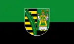 Flag  Coat of arms | |
Location of Land Hadeln within Cuxhaven district 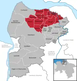 | |
 Land Hadeln 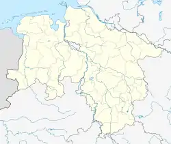 Land Hadeln | |
| Coordinates: 53°48′N 8°54′E / 53.800°N 8.900°E | |
| Country | Germany |
| State | Lower Saxony |
| District | Cuxhaven |
| Founded | 2011-01-01 |
| Subdivisions | 14 |
| Government | |
| • Mayor (2021–26) | Frank Thielebeule[1] |
| Population (2021-12-31)[2] | |
| • Total | 26,847 |
| Time zone | UTC+01:00 (CET) |
| • Summer (DST) | UTC+02:00 (CEST) |
| Website | www.otterndorf.de |
Land Hadeln is a Samtgemeinde ("collective municipality") in the district of Cuxhaven, in Lower Saxony, Germany. Its seat is in the town Otterndorf. It was formed on 1 January 2011 by the merger of the former Samtgemeinden Hadeln and Sietland. On 1 November 2016 the Samtgemeinde Am Dobrock was merged into Land Hadeln.
The Samtgemeinde Land Hadeln consists of the following municipalities:
References
Wikimedia Commons has media related to Samtgemeinde Land Hadeln.
This article is issued from Wikipedia. The text is licensed under Creative Commons - Attribution - Sharealike. Additional terms may apply for the media files.