Langsur | |
|---|---|
 | |
 Coat of arms | |
Location of Langsur within Trier-Saarburg district  | |
 Langsur 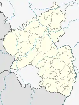 Langsur | |
| Coordinates: 49°43′29″N 6°29′59″E / 49.72472°N 6.49972°E | |
| Country | Germany |
| State | Rhineland-Palatinate |
| District | Trier-Saarburg |
| Municipal assoc. | Trier-Land |
| Government | |
| • Mayor (2019–24) | Reinhold Thiel[1] |
| Area | |
| • Total | 11.93 km2 (4.61 sq mi) |
| Elevation | 154 m (505 ft) |
| Population (2021-12-31)[2] | |
| • Total | 1,804 |
| • Density | 150/km2 (390/sq mi) |
| Time zone | UTC+01:00 (CET) |
| • Summer (DST) | UTC+02:00 (CEST) |
| Postal codes | 54308 |
| Dialling codes | 06501 |
| Vehicle registration | TR |
| Website | www.langsur.info |
Langsur is a municipality in the Trier-Saarburg district, in Rhineland-Palatinate, Germany.
Mesenich

Mesenich is a small German village belonging to the Ortsgemeinde of Langsur. It is located on the north of the verbandsgemeinde, near the Sauertalbrücke, the bridge in which the Bundesautobahn 64, the motorway connecting Luxembourg City and Trier, crosses the Sauer. It is also near a solar park and a natural rock mine.
Wasserbilligerbrück
Wasserbilligerbrück is another small German village belonging to the Ortsgemeinde of Langsur.[3] It is located on the bridge across the Sauer connecting it to the Luxembourgish town of Wasserbillig.[4]
References
- ↑ Direktwahlen 2019, Landkreis Trier-Saarburg, Landeswahlleiter Rheinland-Pfalz, accessed 2 August 2021.
- ↑ "Bevölkerungsstand 2021, Kreise, Gemeinden, Verbandsgemeinden" (in German). Statistisches Landesamt Rheinland-Pfalz. 2022.
- ↑ Müllers Großes Deutsches Ortsbuch 2012: Vollständiges Ortslexikon (in German). Walter de Gruyter. 2012-08-31. p. 1469. ISBN 9783110278064.
- ↑ Kamphausen, Rudolf E.; Strewe, Hans J. (2013-03-08). Reiseverkehrsgeographie (in German). Springer-Verlag. p. 41. ISBN 9783322826497.
This article is issued from Wikipedia. The text is licensed under Creative Commons - Attribution - Sharealike. Additional terms may apply for the media files.