Laniel | |
|---|---|
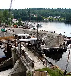
 Boathouse on Lake Kipawa at Laniel | |
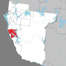
 Location within Témiscamingue RCM | |
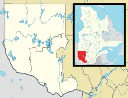
 Laniel Location in western Quebec | |
| Coordinates: 47°03′N 79°16′W / 47.050°N 79.267°W[1] | |
| Country | Canada |
| Province | Quebec |
| Region | Abitibi-Témiscamingue |
| RCM | Témiscamingue |
| Constituted | October 31, 2005 |
| Government | |
| • Federal riding | Abitibi—Témiscamingue |
| • Prov. riding | Rouyn-Noranda–Témiscamingue |
| Area | |
| • Total | 542.07 km2 (209.29 sq mi) |
| • Land | 408.20 km2 (157.61 sq mi) |
| Population (2021)[3] | |
| • Total | 89 |
| • Density | 0.2/km2 (0.5/sq mi) |
| • Pop (2016–21) | |
| • Dwellings | 185 |
| Time zone | UTC−5 (EST) |
| • Summer (DST) | UTC−4 (EDT) |
Laniel is an unorganized territory in the Témiscamingue Regional County Municipality, Abitibi-Témiscamingue region, Quebec, Canada. It surrounds the northern portion of Lake Kipawa.
Laniel is also a hamlet located within this territory at the outflow of Lake Kipawa where Route 101 crosses the Kipawa River. It was named in honour of priest Armand Laniel (1866-1928).[1] The hamlet used to have a post office that opened in 1934.[4]
In addition to the namesake hamlet, the territory also includes the hamlet of Baie-Dorval (46°59′03″N 79°14′23″W / 46.98417°N 79.23972°W). This hamlet, located on Dorval Bay of Lake Kipawa, was founded in the early 20th century and originally called Baie-Stenhouse, after a forestry entrepreneur in the region. Both the bay and hamlet were renamed in 1989, to honour the first settler family that settled on the bay in 1922.[5]
Until 2005, Laniel and Lacs-du-Témiscamingue unorganized territories were part of the Rivière-Kipawa unorganized territory.[6]
Demographics
| 2021 | 2016 | |
|---|---|---|
| Population | 89 (+8.5% from 2016) | 82 (+5.1% from 2011) |
| Land area | 408.20 km2 (157.61 sq mi) | 412.39 km2 (159.22 sq mi) |
| Population density | 0.2/km2 (0.52/sq mi) | 0.2/km2 (0.52/sq mi) |
| Median age | 60.4 (M: 60.4, F: 60.4) | 64.8 (M: 67.2, F: 63.5) |
| Private dwellings | 185 (total) 57 (occupied) | 165 (total) 46 (occupied) |
| Median household income | $.n/a | $48,000 |
| Year | Pop. | ±% |
|---|---|---|
| 2001 | 85 | — |
| 2006 | 150 | +76.5% |
| 2011 | 78 | −48.0% |
| 2016 | 82 | +5.1% |
| 2021 | 89 | +8.5% |
| 2011 population figure based on revised count. 2001 population figure adjusted figure due to boundary change. Source: Statistics Canada[3] | ||

See also
References
- 1 2 "Banque de noms de lieux du Québec: Reference number 390262". toponymie.gouv.qc.ca (in French). Commission de toponymie du Québec.
- 1 2 "Répertoire des municipalités: Geographic code 85905". www.mamh.gouv.qc.ca (in French). Ministère des Affaires municipales et de l'Habitation.
- 1 2 3 "Data table, Census Profile, 2021 Census of Population - Laniel, Unorganized (NO) Quebec Census subdivision". www12.statcan.gc.ca. Government of Canada - Statistics Canada. 9 February 2022. Retrieved 2023-12-13.
- ↑ "Banque de noms de lieux du Québec: Laniel (hameau)". toponymie.gouv.qc.ca (in French). Commission de toponymie du Québec. Retrieved 2023-12-12.
- ↑ "Banque de noms de lieux du Québec: Baie-Dorval (hameau)". toponymie.gouv.qc.ca (in French). Commission de toponymie du Québec. Retrieved 2023-12-12.
- ↑ "Modifications aux municipalités du Québec – Octobre 2005" (PDF). stat.gouv.qc.ca. Institut de la statistique du Québec. October 2005. Archived from the original (PDF) on 30 December 2006. Retrieved 30 June 2022.
- ↑ "2021 Community Profiles". 2021 Canadian Census. Statistics Canada. February 4, 2022. Retrieved 2023-12-12.
- ↑ "2016 Community Profiles". 2016 Canadian Census. Statistics Canada. August 12, 2021. Retrieved 2023-12-12.
- ↑ "2006 Community Profiles". 2006 Canadian Census. Statistics Canada. August 20, 2019.
- ↑ "2001 Community Profiles". 2001 Canadian Census. Statistics Canada. July 18, 2021.
External links
![]() Media related to Laniel, Quebec at Wikimedia Commons
Media related to Laniel, Quebec at Wikimedia Commons