Lanny Jaya Regency
Kabupaten Lanny Jaya | |
|---|---|
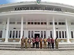
 Office Building of Lanny Jaya Regency | |
 Coat of arms | |
| Motto: Yambunik Labu Eruwok | |
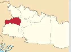
 Location in Highland Papua | |
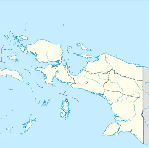
 Lanny Jaya Regency Location in Indonesian Papua  Lanny Jaya Regency Location in Indonesia | |
| Coordinates: 3°54′45″S 138°17′16″E / 3.9124°S 138.2877°E | |
| Country | |
| Province | Highland Papua |
| Capital | Tiom |
| Government | |
| • Regent | Befa Yigibalom |
| • Vice Regent | Yemis Kogoya |
| Area | |
| • Total | 6,077.4 km2 (2,346.5 sq mi) |
| Population (mid 2022 estimate)[1] | |
| • Total | 201,461 |
| • Density | 33/km2 (86/sq mi) |
| Time zone | UTC+9 (Indonesia Eastern Time) |
| Area code | (+62) 969 |
| Website | lannyjayakab |
Lanny Jaya Regency is a regency (kabupaten) located in the Indonesian province of Highland Papua. It covers an area of 6,077.4 km2, and had a population of 148,522 at the 2010 Census[2] and 196,399 at the 2020 Census;[3] the official estimate as at mid 2022 was 201,461.[1] The administrative centre is the town of Tiom.
Administrative Districts
In 2010 the Lanny Jaya Regency comprised ten districts (distrik), listed below with their areas and their populations at the 2010 Census,[2] together with a list of the additional districts formed from parts of the original districts from 2013 onwards.
| Name of District (distrik) | Area in km2 | Pop'n 2010 Census | Extra districts formed from 2013 |
|---|---|---|---|
| Makki | 309.81 | 23,306 | Gupura, Kolawa, Gelok Beam, Awina and Kuly Lanny Districts |
| Pirime | 677.72 | 20,125 | Buguk Gona, Milimbo, Gollo and Wiringgambut Districts |
| Tiom | 813.26 | 21,324 | Nogi, Mokoni, Niname, Yiginua, Tion Ollo, Yugungwi and Lannyna Districts |
| Balingga | 425.99 | 15,046 | Balingga Barat, Bruwa, Ayumnati and Goa Balim Districts |
| Kuyawage | 1,703.98 | 12,235 | Wano Barat District |
| Malagaineri | 1,258.62 | 5,472 | Melagi District |
| Tiomneri | 716.44 | 10,082 | Wereka District |
| Dimba | 290.45 | 14,500 | Kelulome and Nikogwe Districts |
| Gamelia | 174.27 | 14,680 | Karu, Yiluk and Guna Districts |
| Poga | 77.46 | 11,782 | Muara District |
| Totals | 6,448.00 | 148,522 |
Since 2013, the number of districts has been raised to thirty-nine by the splitting of existing districts. These thirty-nine are listed below with their areas and their populations at the 2020 Census,[3] and the official estimates as at mid 2022.[1] The table also includes the location of the district administrative centres, the number of administrative villages in each district (totaling 354 rural kampung and 1 urban kelurahan - the latter being the town of Bokon in Tiom District), and its post code.
| Kode Wilayah | Name of District (distrik) | Area in km2 | Pop'n Census 2020 | Pop'n Estimate mid 2022 | Admin centre | No. of villages | Post code |
|---|---|---|---|---|---|---|---|
| 95.07.03 | Makki | 61.80 | 3,591 | 3,587 | Kemiri | 8 | 99565 |
| 95.07.27 | Gupura | 111.08 | 5,531 | 5,525 | Lelam | 12 | 99562 |
| 95.07.28 | Kolawa | 76.53 | 3,905 | 3,901 | Ambena | 10 | 99563 |
| 95.07.29 | Gelok Beam | 72.30 | 3,788 | 3,784 | Pirambor | 9 | 99561 |
| 95.07.21 | Awina | 121.18 | 4,583 | 4,578 | Nambume | 9 | 99572 |
| 95.07.30 | Kuly Lanny | 55.80 | 2,845 | 2,842 | Indugu | 8 | 99564 |
| 95.07.02 | Pirime | 137.00 | 5,855 | 5,951 | Umbanume | 8 | 99581 |
| 95.07.38 | Buguk Gona | 13.00 | 6,140 | 6,240 | Kabiga | 13 | 99574 |
| 95.07.18 | Milimbo | 249.13 | 5,184 | 5,269 | Milimbo | 8 | 99579 |
| 95.07.20 | Gollo | 373.69 | 4,317 | 4,387 | Golopura | 11 | 99576 |
| 95.07.19 | Wiringgambut | 249.12 | 4,526 | 4,600 | Golo | 10 | 99582 |
| 95.07.01 | Tiom | 281.10 | 10,369 | 10,908 | Bokon | 11 | 99593 |
| 95.07.12 | Nogi | 298.00 | 5,137 | 5,404 | Yirene | 8 | 99592 |
| 95.07.16 | Mokoni | 172.94 | 4,680 | 4,923 | Mokoni | 9 | 99590 |
| 95.07.11 | Niname | 205.30 | 3,884 | 4,086 | Dugume | 7 | 99591 |
| 95.07.13 | Yiginua | 205.30 | 4,058 | 4,268 | Tepogi | 7 | 99598 |
| 95.07.14 | Tiom Ollo | 285.50 | 5,081 | 5,336 | Kumuluk | 10 | 99594 |
| 95.07.15 | Yugungwi | 333.30 | 4,805 | 5,336 | Konikme | 9 | 99599 |
| 95.07.31 | Lannyna | 217.61 | 3,313 | 3,309 | Bonom | 11 | 99578 |
| 95.07.07 | Balingga | 94.70 | 4,289 | 4,469 | Balingga | 10 | 99583 |
| 95.07.26 | Balingga Barat (West Balingga) | 74.57 | 4,237 | 4,415 | Tinggipura | 8 | 99584 |
| 95.07.25 | Bruwa | 93.23 | 9,002 | 9,380 | Bruyugu | 9 | 99585 |
| 95.07.22 | Ayumnati | 238.32 | 4,605 | 4,799 | Anitila | 9 | 99573 |
| 95.07.24 | Goa Balim | 84.71 | 4,732 | 4,692 | Wamitu | 7 | 99586 |
| 95.07.09 | Kuyawage | 163.30 | 3,905 | 3,872 | Wupaga | 8 | 99587 |
| 95.07.23 | Wano Barat (West Wano) | 353.86 | 5,291 | 5,246 | Wamiru | 11 | 99596 |
| 95.07.06 | Melagineri | 90.80 | 5,434 | 6,259 | Malagai | 8 | 99589 |
| 95.07.39 | Melagi | 85.24 | 8,072 | 9,298 | Wabiragi | 8 | 99588 |
| 95.07.08 | Tiomneri | 135.30 | 5,139 | 5,396 | Milinggame | 9 | 99595 |
| 95.07.17 | Wereka | 145.95 | 5,215 | 5,476 | Tabukeker | 9 | 99597 |
| 95.07.05 | Dimba | 110.00 | 3,537 | 3,461 | Dimba | 8 | 99575 |
| 95.07.35 | Kelulome | 234.31 | 4,326 | 4,234 | Kelulome | 10 | 99577 |
| 95.07.36 | Nikogwe | 193.37 | 7,527 | 7,366 | Wanggagome | 9 | 99580 |
| 95.07.04 | Gamelia | 78.20 | 5,178 | 5,173 | Wupi | 8 | 99566 |
| 95.07.32 | Karu | 89.06 | 5,216 | 5,211 | Ayafofa | 8 | 99568 |
| 95.07.33 | Yiluk | 83.85 | 3,598 | 3,595 | Odika | 8 | 99571 |
| 95.07.34 | Guna | 69.02 | 3,377 | 3,374 | Guna | 7 | 99567 |
| 95.07.10 | Poga | 17.30 | 6,937 | 6,746 | Poga | 13 | 99570 |
| 95.07.37 | Muara | 68.59 | 5,190 | 5,047 | Muara | 10 | 99569 |
| Totals | 6,077.40 | 196,399 | 201,461 | Bokon | 355 |
