Laubenheim | |
|---|---|
 Coat of arms | |
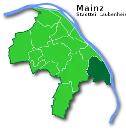
Location of Laubenheim within Mainz  | |
 Laubenheim  Laubenheim | |
| Coordinates: 49°57′N 8°19′E / 49.950°N 8.317°E | |
| Country | Germany |
| State | Rhineland-Palatinate |
| District | Urban district |
| City | Mainz |
| Government | |
| • Local representative | Gerhard Strotkötter (SPD) |
| Area | |
| • Total | 8.8 km2 (3.4 sq mi) |
| Population (2023)[1] | |
| • Total | 9,279 |
| • Density | 1,100/km2 (2,700/sq mi) |
| Time zone | UTC+01:00 (CET) |
| • Summer (DST) | UTC+02:00 (CEST) |
| Postal codes | 55130 |
| Dialling codes | 06131 |
| Website | mz-laubenheim |
Mainz-Laubenheim is a southern quarter of Mainz and is located south of the A60 autobahn and west of the B9 highway on the banks of the Rhine.
History

The first documented mention of Mainz-Laubenheim was in 773 AD, under the name Nubenheim. In 1801, Laubenheim came under French possession, and in 1816 was taken over by the Grand Duchy of Hessen. On 8 June 1969, Laubenheim became part of the city of Mainz.
Traffic
Mainz-Laubenheim is connected to the local railway network by its Mainz-Laubenheim stop, which is part of the Mainz-Mannheim railway line. S-Bahn line S6 of the S-Bahn RheinNeckar stop here every half hour.
Laubenheim is also well connected to the rest of the state capital by several bus lines of the Mainzer Verkehrsgesellschaft (MVG). Depending on the line, the city centre of Mainz can be reached in 15 to 30 minutes.
Furthermore, Mainz-Laubenheim has a connection to the Bundesstraße 9 and, through a connection to the Bundesautobahn 60, to the Mainzer Autobahnring.
Literature
- Claus Wolf (2004). Die Mainzer Stadtteile (in German). Emons Verlag. ISBN 3-89705-361-6.
References
- ↑ "Einwohner nach Stadtteilen am 30.04.2023" (PDF). Landeshauptstadt Mainz. Retrieved 2024-01-10.
External links
- mainz-laubenheim.de
- Vintners and vineyards in Mainz-Laubenheim
- "Laubenheim". mainz.de (in German). Archived from the original on 2015-06-05. Retrieved 2015-06-07.