Laudermarke | |
|---|---|
 Farm in Laudermarke | |
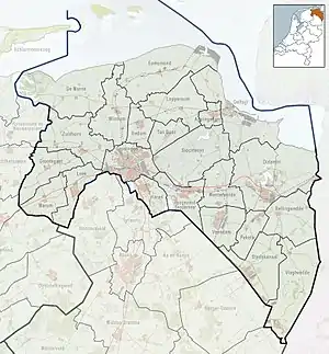 Laudermarke Location in the province of Groningen in the Netherlands | |
| Coordinates: 52°53′26″N 7°6′55″E / 52.89056°N 7.11528°E | |
| Country | Netherlands |
| Province | Groningen |
| Municipality | Westerwolde |
| Area | |
| • Total | 10.28 km2 (3.97 sq mi) |
| Elevation | 12 m (39 ft) |
| Population (2021)[1] | |
| • Total | 115 |
| • Density | 11/km2 (29/sq mi) |
| Postal code | 9561[1] |
| Dialing code | 0599 |
Laudermarke is a hamlet in the Dutch province of Groningen. It is a part of the municipality of Westerwolde, and lies about 19 km northeast of Emmen.
Laudermarke has about 30 houses.[3]
The hamlet was first mentioned in as 1466 Lauder marke, and means "fenced off terrain belonging to Laude.[4] The postal authorities have placed it under Ter Apel.[5]
References
- 1 2 3 "Kerncijfers wijken en buurten 2021". Central Bureau of Statistics. Retrieved 9 April 2022.
- ↑ "Postcodetool for 9561AA". Actueel Hoogtebestand Nederland (in Dutch). Het Waterschapshuis. Retrieved 9 April 2022.
- ↑ "Laudermarke". Plaatsengids (in Dutch). Retrieved 13 March 2022.
- ↑ "Laudermarke - (geografische naam)". Etymologiebank (in Dutch). Retrieved 9 April 2022.
- ↑ "Postcode 9561 in Ter Apel". Postcode bij adres (in Dutch). Retrieved 9 April 2022.
External links
 Media related to Laudermarke at Wikimedia Commons
This article is issued from Wikipedia. The text is licensed under Creative Commons - Attribution - Sharealike. Additional terms may apply for the media files.