| Laurel Mountain State Park | |
|---|---|
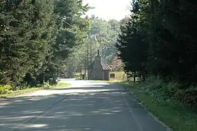
 Near the entrance to the ski area | |
 Location of Laurel Mountain State Park in Pennsylvania  Laurel Mountain State Park (the United States) | |
| Location | Pennsylvania, United States |
| Coordinates | 40°09′53″N 79°09′54″W / 40.16472°N 79.16500°W |
| Area | 493 acres (200 ha) |
| Elevation | 2,723 ft (830 m)[1] |
| Established | 1964 |
| Governing body | Pennsylvania Department of Conservation and Natural Resources |
| Website | Laurel Mountain State Park |
Laurel Mountain State Park is a 493-acre (200 ha) Pennsylvania state park in Ligonier Township, Westmoreland County and Jenner Township, Somerset County, Pennsylvania in the United States.
Geography
Laurel Mountain State Park is 2 miles (3.2 km) south of U.S. Route 30 near Jennerstown. Several communications and broadcast towers are located on the top of Laurel Mountain, which serves the eastern Pittsburgh area and Greater Johnstown.[2]
History
The park was opened as a private ski area in 1939 by General Richard K. Mellon and the Rolling Rock brewery from nearby Latrobe.[3] It was one of the first ski areas in Pennsylvania and although World War II caused the ski resort to be temporarily closed, in the years following the war, it was the "Ski Capital of Pennsylvania". General Mellon leased the land to the state in 1963 and gave it to the state in 1964, when it officially became "Laurel Mountain State Park".
This state park is a ski resort that closed for business in 2005. The ski assets of the park were purchased by Seven Springs Mountain Resort in November 2008 with the goal of reopening the slopes. They would be operated under contract with PA-DCNR by the management of Seven Springs.[4] Seven Springs signed a 10-year lease with PA-DCNR in November 2009. This allows the ski company to move ahead with plans to renovate and reopen the ski slopes.[5]
Nearby state parks
The following state parks are within 30 miles (48 km) of Laurel Mountain State Park:[6][7][8][9]
- Blue Knob State Park (Bedford County)
- Keystone State Park (Westmoreland County)
- Kooser State Park (Somerset County)
- Laurel Hill State Park (Somerset County)
- Laurel Ridge State Park (Cambria, Fayette, Somerset, and Westmoreland counties)
- Laurel Summit State Park (Westmoreland County)
- Linn Run State Park (Westmoreland County)
- Ohiopyle State Park (Fayette County)
- Shawnee State Park (Bedford County)
- Yellow Creek State Park (Indiana County)
References
- ↑ "Laurel Mountain State Park". Geographic Names Information System. United States Geological Survey. August 2, 1979. Retrieved April 27, 2008.
- ↑ "Laurel Mountain State Park". Pennsylvania Department of Conservation and Natural Resources. Archived from the original on February 14, 2004. Retrieved November 29, 2006.
- ↑ "Laurel Mountain State Park". Pennsylvania Department of Conservation and Natural Resources. Archived from the original on September 29, 2011. Retrieved November 29, 2006.
- ↑ "Seven Springs acquires Laurel Mountain ski assets". The Philadelphia Inquirer. December 6, 2008. Retrieved December 9, 2008.
- ↑ Faher, Mike (November 11, 2009). "Seven Springs signs lease to operate Laurel Mountain". The Tribune-Democrat. Archived from the original on February 4, 2013. Retrieved November 21, 2009.
- ↑ Michels, Chris (1997). "Latitude/Longitude Distance Calculation". Northern Arizona University. Retrieved April 23, 2008.
- ↑ "Find a Park by Region (interactive map)". Pennsylvania Department of Conservation and Natural Resources. Archived from the original on September 24, 2011. Retrieved November 18, 2011.
- ↑ 2007 General Highway Map Somerset County Pennsylvania (PDF) (Map). 1:65,000. Pennsylvania Department of Transportation, Bureau of Planning and Research, Geographic Information Division. Retrieved July 27, 2006. Note: shows Laurel Mountain State Park
- ↑ 2007 General Highway Map Westmoreland County Pennsylvania (PDF) (Map). 1:65,000. Pennsylvania Department of Transportation, Bureau of Planning and Research, Geographic Information Division. Retrieved July 27, 2006. Note: shows Laurel Mountain State Park
External links
- "Laurel Mountain State Park — Official map" (PDF). Archived from the original (337 KB) on June 9, 2011.