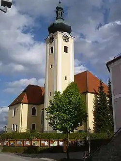
Leopoldschlag | |
|---|---|
 | |
 Coat of arms | |
 Leopoldschlag Location within Austria | |
| Coordinates: 48°37′0″N 14°30′0″E / 48.61667°N 14.50000°E | |
| Country | Austria |
| State | Upper Austria |
| District | Freistadt |
| Government | |
| • Mayor | Alois Böhm (ÖVP) |
| Area | |
| • Total | 25.68 km2 (9.92 sq mi) |
| Elevation | 630 m (2,070 ft) |
| Population (2018-01-01)[2] | |
| • Total | 1,023 |
| • Density | 40/km2 (100/sq mi) |
| Time zone | UTC+1 (CET) |
| • Summer (DST) | UTC+2 (CEST) |
| Postal code | 4262 |
| Area code | 07949 |
| Vehicle registration | FR |
| Website | www.leopoldschlag.at |
Leopoldschlag is a municipality in the district of Freistadt in the Austrian state of Upper Austria. It is located on the European continental divide between the watershed of the Elbe and the Danube, on the border with the Czech Republic.
Population
| Year | Pop. | ±% |
|---|---|---|
| 1869 | 1,380 | — |
| 1880 | 1,317 | −4.6% |
| 1890 | 1,299 | −1.4% |
| 1900 | 1,309 | +0.8% |
| 1910 | 1,267 | −3.2% |
| 1923 | 1,298 | +2.4% |
| 1934 | 1,212 | −6.6% |
| 1939 | 1,135 | −6.4% |
| 1951 | 1,248 | +10.0% |
| 1961 | 1,175 | −5.8% |
| 1971 | 1,189 | +1.2% |
| 1981 | 1,110 | −6.6% |
| 1991 | 1,115 | +0.5% |
| 2001 | 1,086 | −2.6% |
| 2013 | 1,038 | −4.4% |
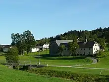
Farm in Mardetschlag
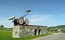
European Water Divide monument
References
- ↑ "Dauersiedlungsraum der Gemeinden Politischen Bezirke und Bundesländer - Gebietsstand 1.1.2018". Statistics Austria. Retrieved 10 March 2019.
- ↑ "Einwohnerzahl 1.1.2018 nach Gemeinden mit Status, Gebietsstand 1.1.2018". Statistics Austria. Retrieved 9 March 2019.
Wikimedia Commons has media related to Leopoldschlag.
This article is issued from Wikipedia. The text is licensed under Creative Commons - Attribution - Sharealike. Additional terms may apply for the media files.