| Designations | |
|---|---|
| Official name | Les Écréhous & Les Dirouilles, Jersey |
| Designated | 2 February 2005 |
| Reference no. | 1455[1] |
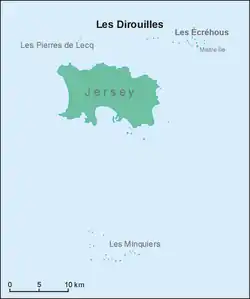
Location map of Les Dirouilles

1940 hand-drawn map of Les Dirouilles
Les Dirouilles (Jèrriais: Les Dithouïl'yes) are a range of rocks to the North-East of Jersey.[2] Historically and administratively, they belong to the parish of Saint Martin.
They have a large range of names, taken individually, and are also known as just Les Pièrres (the rocks).[3]
References
- ↑ "Les Écrehous & Les Dirouilles, Jersey". Ramsar Sites Information Service. Retrieved 25 April 2018.
- ↑ "Les Dithouïl'yes – Les Dirouilles". members.societe-jersiaise.org.
- ↑ R RamsarLesEcrehousManagementPlan (size 1Mb) DM 02022012.pdf
External links
49°19′59″N 2°04′59″W / 49.333°N 2.083°W
This article is issued from Wikipedia. The text is licensed under Creative Commons - Attribution - Sharealike. Additional terms may apply for the media files.