Leutenberg | |
|---|---|
 Town hall | |
 Coat of arms | |
Location of Leutenberg within Saalfeld-Rudolstadt district 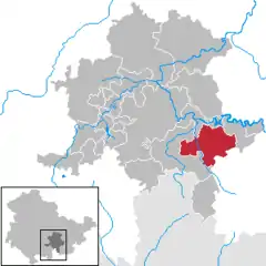 | |
 Leutenberg 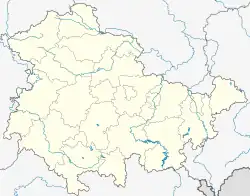 Leutenberg | |
| Coordinates: 50°33′N 11°27′E / 50.550°N 11.450°E | |
| Country | Germany |
| State | Thuringia |
| District | Saalfeld-Rudolstadt |
| Subdivisions | 12 |
| Government | |
| • Mayor (2021–27) | Robert Geheeb[1] |
| Area | |
| • Total | 57.17 km2 (22.07 sq mi) |
| Elevation | 300 m (1,000 ft) |
| Population (2022-12-31)[2] | |
| • Total | 2,027 |
| • Density | 35/km2 (92/sq mi) |
| Time zone | UTC+01:00 (CET) |
| • Summer (DST) | UTC+02:00 (CEST) |
| Postal codes | 07338 |
| Dialling codes | 036734 |
| Vehicle registration | SLF |
| Website | www.leutenberg.de |
Leutenberg is a town in the district of Saalfeld-Rudolstadt, in Thuringia, Germany. It is situated in the Thuringian Forest, 18 km southeast of Saalfeld.
History
Within the German Empire (1871-1918), Leutenberg was part of the Principality of Schwarzburg-Rudolstadt.
References
- ↑ Gewählte Bürgermeister - aktuelle Landesübersicht, Freistaat Thüringen, accessed 8 March 2022.
- ↑ "Bevölkerung der Gemeinden, erfüllenden Gemeinden und Verwaltungsgemeinschaften in Thüringen Gebietsstand: 31.12.2022" (in German). Thüringer Landesamt für Statistik. June 2023.
Towns and municipalities in Saalfeld-Rudolstadt | ||
|---|---|---|
Coat of arms | ||
This article is issued from Wikipedia. The text is licensed under Creative Commons - Attribution - Sharealike. Additional terms may apply for the media files.