Linden Grove | |
|---|---|
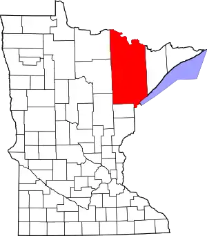
 Linden Grove Location of the community of Linden Grove within Linden Grove Township, Saint Louis County  Linden Grove Linden Grove (the United States) | |
| Coordinates: 47°51′47″N 92°52′14″W / 47.86306°N 92.87056°W | |
| Country | United States |
| State | Minnesota |
| County | Saint Louis |
| Township | Linden Grove Township |
| Elevation | 1,309 ft (399 m) |
| Population | |
| • Total | 10 |
| Time zone | UTC-6 (Central (CST)) |
| • Summer (DST) | UTC-5 (CDT) |
| ZIP code | 55723 |
| Area code | 218 |
| GNIS feature ID | 661723[1] |
Linden Grove is an unincorporated community in Linden Grove Township, Saint Louis County, Minnesota, United States.
The community is 14 miles (23 km) south of Orr, and eight miles (13 km) west of Cook, at the junction of State Highway 1 (MN 1) and State Highway 73 (MN 73).
The Little Fork River flows through the community.
References
- Rand McNally Road Atlas – 2007 edition – Minnesota entry
- Official State of Minnesota Highway Map – 2011/2012 edition
This article is issued from Wikipedia. The text is licensed under Creative Commons - Attribution - Sharealike. Additional terms may apply for the media files.