
.png.webp)
The following is a list of neighborhoods in Austin, Texas.[1][2] Austin generally runs north-south and is bisected by the Colorado River.
Central Austin


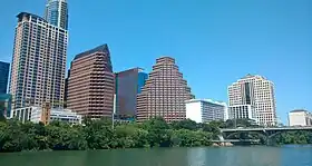
Central Austin includes the city's Downtown and central neighborhoods. The area is north of the Colorado River and is enclosed by Interstate 35 to the east, approximately 51st Street/North Loop/Hancock Drive to the north, and Mopac Expressway (SL 1) to the west.
| Name | COA ID# [nb 1] |
|---|---|
| Bryker Woods | 156 |
| Caswell Heights | 294 |
| Downtown Austin | 402 |
| Eastwoods | 25 |
| Hancock | 31 |
| Heritage | 33 |
| Hyde Park | 34 |
| Judges' Hill | 58 |
| Lower Waller Creek | 960 |
| North University | 48 |
| Oakmont Heights | 185 |
| Old Enfield | 185 |
| Old Pecan Street | 23 |
| Old West Austin | 18 |
| Original Austin | 57 |
| Original West University | 1020 |
| Pemberton Heights | 644 |
| Ridgelea | 63 |
| Ridgetop | 957 |
| Rosedale | 66 |
| Shoal Crest | 259 |
| West Downtown | 1253 |
- Bryker Woods
- Clarksville Historic District
- Caswell Heights
- Downtown Austin
- Eastwoods
- Hancock
- Heritage
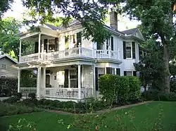
- Hyde Park Historic District
- Judge's Hill
- Lower Waller Creek
- North University
- Oakmont Heights
- Old Enfield
- Old Pecan Street
- Old West Austin
- Original Austin
- Original West University
- Pemberton Heights
- Rosedale
- Ridgelea
- Ridgetop
- Shoal Crest
- Shadow Lawn Historic District
- West Downtown
North Austin
North Austin is defined as a neighborhoods north of Central Austin (51st Street/North Loop/Hancock Drive).
North Central

- Allandale
- Balcones Woods
- Barrington Oaks
- Battle Bend Springs
- Brentwood
- Crestview
- Estates of Brentwood
- Hancock
- Highland
- North Burnet
- North Campus
- North Lamar
- North Loop
- North Shoal Creek
- Saint John
- Wooten
Northeast
North of 51st Street, east of Interstate 35.
Northwest
North of Hancock Drive, west of Mopac Expressway.
- Canyon Creek
- Great Hills/Arboretum
- Northwest Hills
Far North
North of Parmer Lane.
- Copperfield
- Wells Branch
- Scofield Farms
East Austin

East Austin is defined as areas east of Interstate 35 north of the river.
- Central East Austin
- East Cesar Chavez
- East Congress
- East End
- French Place
- Govalle
- Holly
- Mueller
West Austin

West Austin occupies a much smaller area due to the bend of the Colorado River. The area is bounded by Mopac Expressway (SL 1) to the east, the Colorado River to the south and west, and Northland Drive (RM 2222) to the north.
- Far West
- Tarrytown
- West Congress
- West End
- West Line Historic District
South Austin
South Austin generally includes any area south of the Colorado River.
.JPG.webp)


South Central
South Central Austin is boxed by Mopac Expressway to the west, the Colorado River to the north, Interstate 35 to the east, and Ben White Boulevard to the south.
Southeast Central/Riverside
Southeastern Austin between the Colorado River and Ben White Boulevard is generally called the Riverside area.
- East Riverside-Oltorf
- Montopolis
- Pleasant Valley
Southeast
Neighborhoods east of Menchaca Road and south of Ben White Boulevard.
- Dove Springs
- Onion Creek
- South Manchaca
- Southeast Austin
- Southpark Meadows
Southwest
Neighborhoods west of Menchaca Road and south of Ben White Boulevard and Capital of Texas Highway.
- Cherry Creek
- Circle C Ranch
- Oak Hill
- Far South Austin/Slaughter-Manchaca
- Kincheonville
- The Ridge at Lantana
- Maple Run
- Sendera
- Shady Hollow
- Sunset Valley (incorporated city)
- Tanglewood Forest
- Travis Country
- Westgate
- Woodstone Village
Notes
- ↑ City of Austin Planning Identification Number
References
- ↑ "Austin, Texas Neighborhood Map - Income, House Prices, Occupations, Boundaries". City-Data.com. Advameg, Inc. Retrieved 5 December 2012.
- ↑ Austin Neighborhood Council. "Neighborhood Associations". Austin Neighborhood Council. Archived from the original on 16 November 2012. Retrieved 5 December 2012.