
This list is about the Sierra Nevada of California, United States.
Principal mountains

Mount Whitney
List of mountains over 14,000 ft (4250 m) with 300 ft (90 m) of prominence:[1]
- Mount Whitney 14,505 ft (4421 m)
- Mount Williamson 14,403 ft (4390 m)
- North Palisade 14,242 ft (4341 m)
- Mount Sill 14,153 ft (4314 m)
- Mount Russell 14,094 ft (4296 m)
- Split Mountain 14,064 ft (4286 m)
- Mount Langley 14,025 ft (4280 m)
- Mount Tyndall 14,019 ft (4273 m)
- Middle Palisade 14,012 ft (4271 m)
- Mount Muir 14,012 ft (4271 m)
Other notable peaks:
- Mount Baxter
- Black Kaweah
- Castle Peak
- Cathedral Peak
- Johnson Peak, the highest mountain in Tuolumne Meadows
- El Capitan
- Mount Conness
- Mount Dana
- Mount Darwin
- Mount Davis
- Fresno Dome
- Mount Gibbs
- Half Dome
- Mount Hopkins
- Mount Humphreys
- Mount Huntington
- Lembert Dome
- Liberty Cap
- Mount Lyell
- Maggies Peaks
- Mammoth Mountain
- Matterhorn Peak
- The Minarets
- Mount Morgan
- Mount Morrison
- Pyramid Peak
- Red Kaweah
- Red Slate Mountain
- Mount Ritter
- Shuteye Peak
- Thunderbolt Peak
- Mount Tom
Subranges
Counties in the Sierra

Sonora Peak, highest point in Alpine County
- Alpine County, California
- Amador County, California
- Butte County, California
- Calaveras County, California
- El Dorado County, California
- Fresno County, California
- Inyo County, California
- Kern County, California
- Madera County, California
- Mariposa County, California
- Mono County, California
- Nevada County, California
- Placer County, California
- Plumas County, California
- Sierra County, California
- Tulare County, California
- Tuolumne County, California
- Yuba County, California
The Carson Range (a spur of the Sierra) extends into Nevada:
Principal rivers

The headwaters of the San Joaquin River
Prominent Lakes
.jpg.webp)
Mono Lake as seen from Mount Dana.
Other natural features
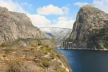
Hetch Hetchy Valley
National parks and monuments
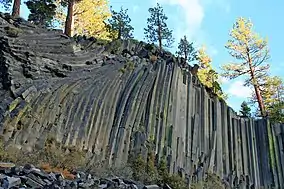
Devils Postpile
North to south:
- Yosemite National Park
- Kings Canyon National Park
- Sequoia National Park
- Giant Sequoia National Monument
Eastern side of the Sierra:
National forests
Wilderness areas
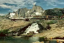
Mount Ritter and Banner Peak in the Ansel Adams Wilderness
A total of over 3,726,000 acres (15,080 km2) in 26 separate areas[2]
- Ansel Adams
- Bright Star
- Bucks Lake
- Carson-Iceberg
- Chimney Peak
- Desolation
- Dinkey Lakes
- Domeland
- Emigrant
- Golden Trout
- Granite Chief
- Hoover
- Jennie Lakes
- John Krebs
- John Muir
- Kaiser
- Kiavah
- Mokelumne
- Monarch
- Mount Rose
- Owens Peak
- Owens River Headwaters
- Sacatar Trail
- Sequoia-Kings Canyon
- South Sierra
- Yosemite
State Parks
California
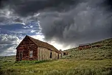
Bodie State Historic Park
- Auburn State Recreation Area
- Bodie State Historic Park
- Burton Creek State Park
- Calaveras Big Trees State Park
- California State Mining and Mineral Museum Park Property
- Columbia State Historic Park
- D. L. Bliss State Park
- Donner Memorial State Park
- Emerald Bay State Park
- Empire Mine State Historic Park
- Folsom Lake State Recreation Area
- Folsom Powerhouse State Historic Park
- Grover Hot Springs State Park
- Indian Grinding Rock State Historic Park
- Kings Beach State Recreation Area
- Lake Valley State Recreation Area
- Malakoff Diggins State Historic Park
- Marshall Gold Discovery State Historic Park
- Millerton Lake State Recreation Area
- Mono Lake Tufa State Reserve
- Prairie City State Vehicular Recreation Area
- Railtown 1897 State Historic Park
- South Yuba River State Park
- Stone Lake Park Property
- Sugar Pine Point Light
- Tahoe State Recreation Area
- Ward Creek Park Property
- Washoe Meadows State Park
- Wassama Round House State Historic Park
Nevada
Trails and routes
- John Muir Trail
- Pacific Crest Trail
- Four Mile Trail
- Hetch Hetchy to Lake Vernon Trail
- High Sierra Trail
- Independence Trail
- Lower Sagehen Creek Hiking Trail
- Mist Trail
- Mount Whitney Trail
- Sierra High Route
- Silver Knapsack Trail
- Tahoe Rim Trail
- Tahoe–Yosemite Trail
- Theodore Solomons Trail
- Trans-Sierra Highway
Giant sequoia
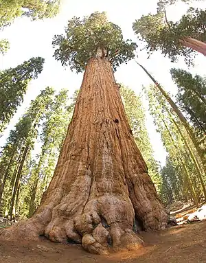
General Sherman Tree
Mountain passes
Fires

Rim Fire
- Cedar Fire (2003)
- Rim Fire (2013)
- Thomas Fire (2017)
- Mendocino Complex (2018)
- August Complex fire (2020)
- North Complex Fire (2020)
- LNU Lightning Complex fires (2020)
- SCU Lightning Complex fires (2020)
- SQF Complex (2020)
- Creek Fire (2020)
- Caldor Fire (2021)
- Dixie Fire (2021)
- Oak Fire (2022)
- Washburn Fire (2022)
People related to the Sierra Nevada
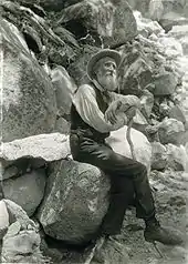
John Muir
Relevant list articles
See also
References
- ↑ "California 13,500-foot Peaks". Peakbagger.com.
- ↑ "Wilderness Areas in the Sierra Nevada". Archived from the original on 2017-09-27. Retrieved 2017-09-27.
This article is issued from Wikipedia. The text is licensed under Creative Commons - Attribution - Sharealike. Additional terms may apply for the media files.