
Map of Haiti

The National Palace in Port-au-Prince, Haiti before the 2010 earthquake.

The well-preserved Cathedral Notre-Dame of Cap-Haïtien
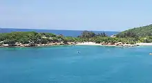
Labadee beach and village
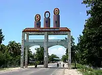
Les Cayes entrance
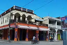
Colonial architecture in Les Cayes

Church in Anse d'Hainault

Administrative center in Corail

Jean-Jacques Dessalines Legacy Statue

Saut-d'Eau Waterfall

Les Cayes Cathedral

Labadee beach, Haïti, close to Cap-Haïtien
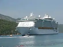
In Labadee, Haïti, Freedom of the Seas is docked

Hotel de Ville (City Hall), site of the City Council, Cap Haïtien

An old gingerbread house in Pacot

The Universite Roi Henri Christophe in Limonade

Milot from the gates of the Sans-Souci Palace

The beach resort of Club Indigo near Saint-Marc

Cathedral of Jérémie

Limbé river
.jpg.webp)
Le Musée de Guahaba/Guahaba Museum

Sunset on the beach in Port-Salut
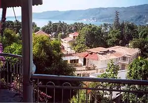
View of Jacmel

Anse du Clerc

Streets, Dame-Marie

A street scene in Cap Haïtien
A "tap tap" bus, used for public transportation

A view of the beach at Paradis

View of the Citadelle Laferrière, in northern Haiti

Front view of Sans-Souci Palace

Inside the ruins of Sans-Souci Palace
List
See also
References
External links
![]() Media related to Populated places in Haiti at Wikimedia Commons
Media related to Populated places in Haiti at Wikimedia Commons
This article is issued from Wikipedia. The text is licensed under Creative Commons - Attribution - Sharealike. Additional terms may apply for the media files.