This is a list of places within the ceremonial county of Lancashire, England. This refers to the present-day boundaries of administrative Lancashire, which came into effect in 1974. For a list of places within the larger historic county, see List of Places historically in Lancashire.
A
B
- Bacup
- Balderstone
- Bamber Bridge
- Banks
- Barley
- Barnoldswick
- Barrow Nook
- Barrowford
- Barton (Preston)
- Barton (West Lancashire)
- Bashall Eaves
- Baxenden
- Belmont
- Belthorn
- Bickerstaffe
- Billington,
- Bispham
- Bispham Green
- Blackamoor
- Blacko
- Blackburn
- Blackpool
- Bleasdale
- Bolton-by-Bowland
- Bolton-le-Sands
- Borwick
- Bretherton
- Brierfield
- Brindle
- Brinscall
- Brockhall
- Broughton
- Buckshaw Village
- Burnley
- Burscough
Ashurst Beacon, Dalton
Barnoldswick

Carnforth Station

Forest of Bowland, Ward's stone
Helmshore Museum
Lathom House, West Wing

Ormskirk Market

Rufford Old Hall
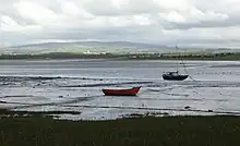
Sunderland Point, River Lune
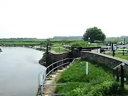
Tarleton Lock, Leeds and Liverpool Canal

Winter Hill mast
C
- Calder Vale
- Cantsfield
- Carnforth
- Catforth
- Caton
- Catterall
- Chapeltown
- Charnock Richard
- Chatburn
- Chipping
- Chingle Hall
- Chorley
- Church
- Churchtown
- Claughton-on-Brock
- Claughton (Lancaster)
- Clayton-le-Dale
- Clayton-le-Moors
- Clayton-le-Woods
- Clayton Brook
- Cleveleys
- Clifton
- Clitheroe
- Cliviger
- Clowbridge
- Cockerham
- Colne
- Conder Green
- Coppull
- Copster Green
- Corner Row
- Cottam
- Cottontree
- Coupe Green
- Cowan Bridge
- Crawford
- Crawshawbooth
- Croston
- Cuerden
D
E
F
G
H
I
K
L
M
N
O
P
Q
R
S
T
U
W
- Waddington
- Walton-le-Dale
- Warton (Fylde)
- Warton (Lancaster)
- Waterfoot
- Weeton
- Wennington
- Wesham
- West Bradford
- Westhead
- Whalley
- Whalley Range
- Wheelton
- Whitechapel
- White Coppice
- Whitestake
- Whitewell
- Whittington
- Whittle-le-Woods
- Whitworth
- Wilpshire
- Winewall
- Wiswell
- Withnell
- Withnell Fold
- Woodplumpton
- Worsthorne
- Wray
- Wrea Green
- Wrightington
Y
See also
- List of settlements in Lancashire by population
- Civil parishes in Lancashire
- List of places historically in Lancashire for pre-1974 boundaries
- List of places in England for lists in other counties
External links
This article is issued from Wikipedia. The text is licensed under Creative Commons - Attribution - Sharealike. Additional terms may apply for the media files.