Litava | |
|---|---|
Village | |
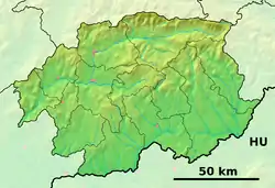 Litava Location of Litava in the Banská Bystrica Region 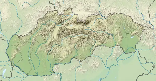 Litava Location of Litava in Slovakia | |
| Coordinates: 48°17′56″N 19°10′46″E / 48.29889°N 19.17944°E | |
| Country | |
| Region | Banská Bystrica |
| District | Krupina |
| First mentioned | 1135 |
| Government | |
| • Mayor | Ľubica Tuhárska |
| Area | |
| • Total | 22.12[1] km2 (8.54[1] sq mi) |
| Elevation | 430[2] m (1,410[2] ft) |
| Population (2021) | |
| • Total | 758[3] |
| Time zone | UTC+1 (CET) |
| • Summer (DST) | UTC+2 (CEST) |
| Postal code | 962 44[2] |
| Area code | +421 45[2] |
| Car plate | KA |
| Website | www.obeclitava.sk |
Litava (Hungarian: Litva) is a village and municipality in the Krupina District of the Banská Bystrica Region of Slovakia.
History
The village was mentioned for the first time in a document from 1135. Already in this year a Romanesque chapel was present in the village. With the presence of this church, the village served as a kind of spiritual, cultural and social center of the region since the 12th century. In the 15th century Litava was a tolling point. In 1496 already the village had its own mill. In 1613 a wooden school stood in the middle of the village which was rebuilt into a brick school in 1811.[4]
References
- 1 2 "Hustota obyvateľstva - obce [om7014rr_ukaz: Rozloha (Štvorcový meter)]". www.statistics.sk (in Slovak). Statistical Office of the Slovak Republic. 2022-03-31. Retrieved 2022-03-31.
- 1 2 3 4 "Základná charakteristika". www.statistics.sk (in Slovak). Statistical Office of the Slovak Republic. 2015-04-17. Retrieved 2022-03-31.
- ↑ "Počet obyvateľov podľa pohlavia - obce (ročne)". www.statistics.sk (in Slovak). Statistical Office of the Slovak Republic. 2022-03-31. Retrieved 2022-03-31.
- ↑ "Obec Litava | Obec Litava".
External links
This article is issued from Wikipedia. The text is licensed under Creative Commons - Attribution - Sharealike. Additional terms may apply for the media files.