Litian Town
李畋镇 | |
|---|---|
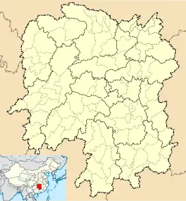
 Litian Town Location in Hunan | |
| Coordinates: 27°51′28″N 113°41′01″E / 27.857855°N 113.683688°E | |
| Country | People's Republic of China |
| Province | Hunan |
| Prefecture-level city | Zhuzhou |
| County-level city | Liling |
| Area | |
| • Total | 122.59 km2 (47.33 sq mi) |
| Population (2016) | 62,800 |
| Time zone | UTC+8 (China Standard) |
| Postal code | 412299 |
| Area code | 0731 |
Litian (Chinese: 李畋镇; pinyin: Lǐtián zhèn) is a town of Liling City in Hunan Province, China. It is surrounded by Jingang Town on the north, Shangli County on the east, Guanzhuang Town on the west, and Baitutan Town on the south.
History
The town was established by merging 14 villages of the historic Nanqiao Town (南桥镇) and 7 villages of the historic Fuli Town (富里镇) on November 26, 2015. As of 2015, it had a population of 62,800 and an area of 122.59 square kilometers.[1]
Administrative division
The town is divided into 21 villages and 2 communities.
| English name | Chinese name | Notes |
|---|---|---|
| Nanqiao Village | 南桥村 | |
| Dongtang Village | 东塘村 | |
| Xinghuo Village | 星火村 | |
| Tongtang Village | 潼塘村 | |
| Jiangtang Village | 将塘村 | |
| Xinshu Village | 新树村 | |
| Qingshui Village | 清水村 | |
| Taiping Village | 大平村 | |
| Fengxing Village | 凤形村 | |
| Yumin Village | 裕民村 | |
| Minglan Village | 明兰村 | |
| Shixi Village | 石溪村 | |
| Hongyuan Village | 洪源村 | |
| Huamai Village | 花麦村 | |
| Huabu Village | 华埠村 | |
| Tangfang Village | 塘坊村 | |
| Cheshang Village | 车上村 | |
| Liqun Village | 利群村 | |
| Fuli Village | 富里村 | |
| Mashi Village | 麻石村 | |
| Shuangjiang Village | 双江村 | |
| Haitang Community | 海棠社区 | |
| Nanyuan Community | 南园社区 | |
Education
There are two middle schools and one primary school in the town: Nanqiao Middle School, Fuli Middle School and Nanqiao Central Primary School.
Transportation
Railway
Shanghai–Kunming railway and Shanghai–Kunming high-speed railway, from Shanghai to Kunming, southwest China's Yunnan, through Litian Town.[2]
National Highway
The G106 National Highway runs north-south through Litian Town.[2]
References
- ↑
- 湖南省民政厅关于同意醴陵市乡镇区划调整方案的批复 (湘民行发〔2015〕85号). rednet.cn. 2015-12-04., also see
- 湖南省乡镇区划调整改革109个县市区批复方案. 人民网. 2015-12-08. or
- 湖南省乡镇区划调整改革109个县市区批复方案. Xinhua. 2015-12-08.
- 1 2 Zhang Hong, ed. (2018). 《中国分省系列地图册:湖南》 [Maps of Provinces in China: Hunan] (in Chinese). Xicheng District, Beijing: SinoMaps Press. pp. 42–43. ISBN 978-7-5031-8949-4.