Liubashivka
Любашівка | |
|---|---|
| Liubashivka | |
 | |
 Flag  Coat of arms | |
 Liubashivka Location of Liubashivka  Liubashivka Liubashivka (Odesa Oblast) | |
| Coordinates: 47°50′9″N 30°15′51″E / 47.83583°N 30.26417°E | |
| Country | |
| Oblast | |
| Raion | |
| Established | 18th century |
| Town status | from 1957 |
| Government | |
| • Mayor | Bohdan Pavlov |
| Area | |
| • Total | 8.87 km2 (3.42 sq mi) |
| Population (2001) | |
| • Total | 11,500 |
| • Density | 1,103/km2 (2,860/sq mi) |
| Area code | UA 66500 |
| Website | Любашівська громада |
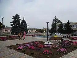
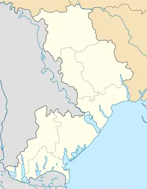
Liubashivka (Ukrainian: Любаші́вка, Ljubašívka, Russian: Любашёвка) is an urban-type settlement in Podilsk Raion of Odesa Oblast (region), Ukraine, located of south-western Ukraine. Liubashivka hosts the administration of Liubashivka settlement hromada, one of the hromadas of Ukraine.[1] Population: 8,729 (2022 estimate).[2]
Town was founded in the 18th century. Liubashivka is primarily Ukrainophone.
Liubashivka is an important transport center and located approximately 160 kilometers from the region capital, Odesa. The town lies on a route Highway05/European route 95: Kyiv — Odesa — Merzifon.
Through the territory of the Liubashivka pass the railroad routes. A railway from Odesa to Kropyvnytskyi and a railway station were built here in 1868.
Many armies passed through town in the period from 1917 to 1920, when Ukraine gained its independence from Russia for a short period of time. They represented different powers: Russian Bolsheviks, Central Council of Ukraine, Mahno movement and the White movement. With the end of the war, the Communist Party assumed complete control of the country. The Bolsheviks leader Joseph Stalin launched a command economy, rapid industrialization and collectivization of its agriculture. The Stalin's Ukrainian famine (1932—1933), or Holodomor was one of the largest national catastrophes in the modern history of Liubashivka.
Until World War II the town had a Jewish community. In 1940 Jewish population was 2500. In 1990 Jewish population was only 5 persons.
During World War II Liubashivka was occupied by Romanian and German forces (1941—1944). In 1991, after the collapse of Communism, the city became part of newly independent Ukraine.
Until 18 July 2020, Liubashivka was the administrative center of Liubashivka Raion. The raion was abolished in July 2020 as part of the administrative reform of Ukraine, which reduced the number of raions of Odesa Oblast to seven. The area of Liubashivka Raion was merged into Podilsk Raion.[3][4]
There are two schools, one hospital, a railway station, and a hotel.
Climate
| Climate data for Liubashivka (1981–2010) | |||||||||||||
|---|---|---|---|---|---|---|---|---|---|---|---|---|---|
| Month | Jan | Feb | Mar | Apr | May | Jun | Jul | Aug | Sep | Oct | Nov | Dec | Year |
| Mean daily maximum °C (°F) | −0.4 (31.3) |
1.0 (33.8) |
6.7 (44.1) |
15.2 (59.4) |
21.8 (71.2) |
24.8 (76.6) |
27.2 (81.0) |
26.9 (80.4) |
21.1 (70.0) |
14.1 (57.4) |
6.1 (43.0) |
1.0 (33.8) |
13.8 (56.8) |
| Daily mean °C (°F) | −3.3 (26.1) |
−2.5 (27.5) |
2.2 (36.0) |
9.4 (48.9) |
15.6 (60.1) |
18.9 (66.0) |
21.1 (70.0) |
20.7 (69.3) |
15.3 (59.5) |
9.2 (48.6) |
2.7 (36.9) |
−1.8 (28.8) |
9.0 (48.2) |
| Mean daily minimum °C (°F) | −5.8 (21.6) |
−5.4 (22.3) |
−1.4 (29.5) |
4.4 (39.9) |
9.8 (49.6) |
13.6 (56.5) |
15.5 (59.9) |
14.9 (58.8) |
10.2 (50.4) |
5.1 (41.2) |
0.0 (32.0) |
−4.2 (24.4) |
4.7 (40.5) |
| Average precipitation mm (inches) | 30.7 (1.21) |
27.7 (1.09) |
29.6 (1.17) |
35.8 (1.41) |
48.4 (1.91) |
68.8 (2.71) |
71.0 (2.80) |
51.3 (2.02) |
53.3 (2.10) |
36.9 (1.45) |
40.9 (1.61) |
36.1 (1.42) |
530.5 (20.89) |
| Average precipitation days (≥ 1.0 mm) | 6.5 | 6.3 | 5.8 | 6.8 | 6.9 | 9.0 | 7.0 | 5.2 | 5.9 | 4.9 | 6.6 | 6.6 | 77.5 |
| Average relative humidity (%) | 85.0 | 82.0 | 76.2 | 65.3 | 62.3 | 67.3 | 65.2 | 62.6 | 68.6 | 76.3 | 85.2 | 86.8 | 73.6 |
| Source: World Meteorological Organization[5] | |||||||||||||
See also
References
- ↑ "Любашовская громада" (in Russian). Портал об'єднаних громад України.
- ↑ Чисельність наявного населення України на 1 січня 2022 [Number of Present Population of Ukraine, as of January 1, 2022] (PDF) (in Ukrainian and English). Kyiv: State Statistics Service of Ukraine. Archived (PDF) from the original on 4 July 2022.
- ↑ "Про утворення та ліквідацію районів. Постанова Верховної Ради України № 807-ІХ". Голос України (in Ukrainian). 2020-07-18. Retrieved 2020-10-03.
- ↑ "Нові райони: карти + склад" (in Ukrainian). Міністерство розвитку громад та територій України.
- ↑ "World Meteorological Organization Climate Normals for 1981–2010". World Meteorological Organization. Archived from the original on 17 July 2021. Retrieved 17 July 2021.