Lles de Cerdanya | |
|---|---|
.JPG.webp) Travesseres | |
 Coat of arms | |
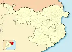 Lles de Cerdanya Location in Catalonia  Lles de Cerdanya Lles de Cerdanya (Spain) | |
| Coordinates: 42°23′32″N 1°41′17″E / 42.39222°N 1.68806°E | |
| Country | |
| Autonomous community | |
| Province | Lleida |
| Comarca | Cerdanya |
| Government | |
| • Mayor | Andreu Grau Ginesta (2015)[1] |
| Area | |
| • Total | 102.8 km2 (39.7 sq mi) |
| Elevation | 1,471 m (4,826 ft) |
| Population (2018)[3] | |
| • Total | 255 |
| • Density | 2.5/km2 (6.4/sq mi) |
| Time zone | UTC+1 (CET) |
| • Summer (DST) | UTC+2 (CEST) |
| Postal code | 25726 |
| Website | lles |
Lles de Cerdanya (formerly known as simply Lles)[4] is a Pyrrenean village in the comarca of Cerdanya, province of Lleida, Catalonia, north-eastern Spain. It is located south of the border with Andorra and France and home to two ski resorts, Lles and Aransa.
References
- ↑ "Ajuntament de Lles de Cerdanya". Generalitat of Catalonia. Retrieved 2015-11-13.
- ↑ "El municipi en xifres: Lles de Cerdanya". Statistical Institute of Catalonia. Retrieved 2015-11-23.
- ↑ Municipal Register of Spain 2018. National Statistics Institute.
- ↑ "INEbase. Alterations to the municipalities". www.ine.es. Retrieved 2021-03-31.
External links
- Official municipal website
- Government data pages (in Catalan)
Places adjacent to Lles de Cerdanya | ||||||||||||||||
|---|---|---|---|---|---|---|---|---|---|---|---|---|---|---|---|---|
| ||||||||||||||||
This article is issued from Wikipedia. The text is licensed under Creative Commons - Attribution - Sharealike. Additional terms may apply for the media files.