| Lokka Reservoir | |
|---|---|
 Lokka reservoir seen from embankment dam in Lokka village. | |
 Lokka Reservoir | |
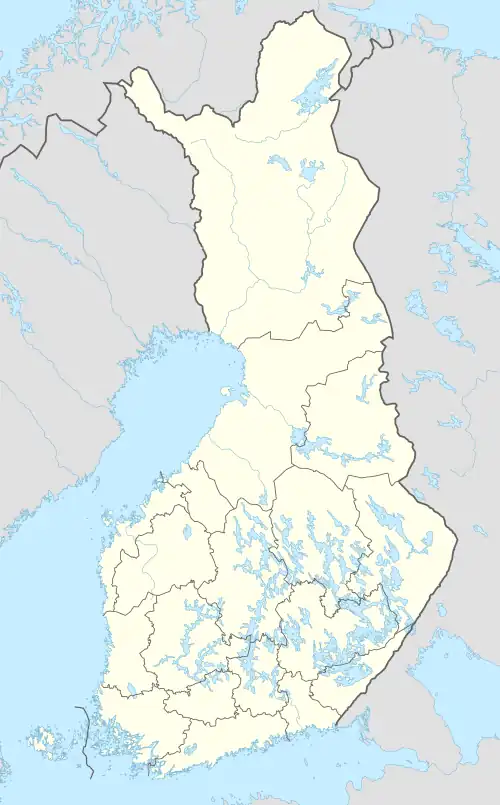
 Location of the lake in Finland | |
| Location | Sodankylä |
| Coordinates | 67°49′12″N 27°45′00″E / 67.82000°N 27.75000°E |
| Type | reservoir |
| Primary inflows | Luiro |
| Primary outflows | Luiro |
| Basin countries | Finland |
| Surface area | 216–418 km2 (83–161 sq mi) |
| Surface elevation | 240–245 m (787–804 ft) |
The Lokka Reservoir (in Finnish: Lokan tekojärvi, Lokan allas, short form Lokka), is a reservoir, upstream of the Luiro River in Sodankylä, in northern Finland. Depending on the water level, its area ranges from 216 to 418 km². The corresponding water levels above mean sea level are 240–245 meters. The filling of the reservoir Lokka began in 1967, and with this reservoir, the amount of water coming to the power plants in Kemijoki could be regulated. Lokka has also been famous for its rich fish population. There are also populations of white-tailed eagles at the reservoir. These do not migrate south for the winter, instead they stay at Lokka to feed on fish left by local fishermen.
Lokka is connected to the Porttipahta Reservoir through the Vuotso Canal.
| Climate data for Sodankylä Lokka, 1991-2020 normals, extremes 1959-present | |||||||||||||
|---|---|---|---|---|---|---|---|---|---|---|---|---|---|
| Month | Jan | Feb | Mar | Apr | May | Jun | Jul | Aug | Sep | Oct | Nov | Dec | Year |
| Record high °C (°F) | 5.4 (41.7) |
5.6 (42.1) |
8.8 (47.8) |
16.5 (61.7) |
27.1 (80.8) |
31.5 (88.7) |
30.8 (87.4) |
30.3 (86.5) |
21.5 (70.7) |
14.5 (58.1) |
7.7 (45.9) |
6.4 (43.5) |
31.5 (88.7) |
| Mean daily maximum °C (°F) | −8.5 (16.7) |
−8.4 (16.9) |
−3.5 (25.7) |
2.3 (36.1) |
8.6 (47.5) |
15.3 (59.5) |
18.8 (65.8) |
16.0 (60.8) |
10.0 (50.0) |
2.2 (36.0) |
−3.3 (26.1) |
−6.2 (20.8) |
3.6 (38.5) |
| Daily mean °C (°F) | −12.7 (9.1) |
−12.5 (9.5) |
−8.3 (17.1) |
−2.1 (28.2) |
4.0 (39.2) |
10.6 (51.1) |
14.1 (57.4) |
11.6 (52.9) |
6.5 (43.7) |
−0.2 (31.6) |
−6.3 (20.7) |
−10.0 (14.0) |
−0.4 (31.3) |
| Mean daily minimum °C (°F) | −17.7 (0.1) |
−17.6 (0.3) |
−14 (7) |
−7.2 (19.0) |
−0.4 (31.3) |
6.0 (42.8) |
9.2 (48.6) |
7.0 (44.6) |
2.7 (36.9) |
−3.1 (26.4) |
−9.9 (14.2) |
−14.5 (5.9) |
−5.0 (23.0) |
| Record low °C (°F) | −48 (−54) |
−48 (−54) |
−41.4 (−42.5) |
−31.5 (−24.7) |
−21.8 (−7.2) |
−4.0 (24.8) |
−2.4 (27.7) |
−6.6 (20.1) |
−17.4 (0.7) |
−30 (−22) |
−35.2 (−31.4) |
−40.6 (−41.1) |
−48 (−54) |
| Average precipitation mm (inches) | 37 (1.5) |
33 (1.3) |
31 (1.2) |
31 (1.2) |
41 (1.6) |
59 (2.3) |
69 (2.7) |
58 (2.3) |
54 (2.1) |
49 (1.9) |
45 (1.8) |
42 (1.7) |
549 (21.6) |
| Average precipitation days (≥ 0.1 mm) | 19 | 17 | 15 | 14 | 14 | 14 | 16 | 15 | 15 | 18 | 20 | 20 | 197 |
| Source 1: FMI normals for Finland 1991-2020[1] | |||||||||||||
| Source 2: Record highs and lows[2] | |||||||||||||
References
- ↑ "FMI normals 1991-2020". fmi.fi. Retrieved 27 October 2023.
- ↑ "FMI data". FMI. Retrieved 27 October 2023.