| Tres Picachos | |
|---|---|
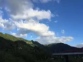
 Tres Picachos from the southwest. | |
| Highest point | |
| Elevation | 968 m (3,176 ft) |
| Coordinates | 18°12′53″N 66°32′29″W / 18.21472°N 66.54139°W |
| Naming | |
| English translation | Three Peaks |
| Language of name | Spanish |
| Geography | |
 Tres Picachos | |
| Parent range | Cordillera Central |
| Climbing | |
| Easiest route | Hike |
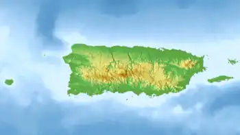
Tres Picachos (Spanish for Three Little Peaks) is one of the highest peaks in Puerto Rico at 968 meters (3,176 ft). It is located on the border between the municipalities of Ciales and Jayuya[1] in the central part of the island, and is part of the Cordillera Central.[2][3]
The mountain has three joint peaks from which the name is derived. It is believed that Taíno Indians thought the mountain to be sacred.
References
- ↑ US Geological Survey
- ↑ "Bosque Estatal Los Tres Picachos" (PDF). drna.pr.gov/. Estado Libre Asociado de Puerto Rico Departamento de Recursos Naturales y Ambientales. Retrieved 24 August 2020.
- ↑ Weaver, Peter L. "La sierra de Luquillo: los recursos forestales y su historia" (PDF). USDA (in Spanish). p. 24. Retrieved 9 September 2021.
This article is issued from Wikipedia. The text is licensed under Creative Commons - Attribution - Sharealike. Additional terms may apply for the media files.