| Mühlauer Bach | |
|---|---|
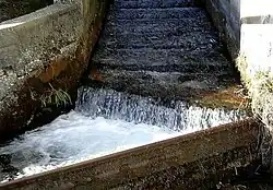
 Bend of river at Mühlau | |
| Location | |
| Country | Austria |
| State | Tyrol |
| Physical characteristics | |
| Source | |
| • location | on the Arzler Reise above Innsbruck |
| • elevation | 1,138 m (3,734 ft) |
| Mouth | |
• location | Inn |
• coordinates | 47°16′49″N 11°24′39″E / 47.2802°N 11.4107°E |
| Length | 2.9 km (1.8 mi) [1] |
| Basin features | |
| Progression | Inn→ Danube→ Black Sea |
The Mühlauer Bach is a river of Tyrol, Austria. It is a left-side tributary of the Inn.
The Mühlauer Bach originates at an elevation of 1,138 m (AA) on the Arzler Reise, the cirque below the Arzler Scharte. It flows in southern direction through Mühlau, a district of Innsbruck, where it discharges into the Inn. Next to the Inn, the Mühlauer Bach is the richest flowing waters of the city. It has a length of just under 3 km (1.9 mi). With the exception of the source, it lies in full in the Innsbruck city area.
Usage
The upper course until the Schillersiedlung has Grade A quality. There is also the main water reservoir of the entire city. The Mühlauer Bach is also important for industrial purposes because a power plant in Mühlau provides the nearby commercial district with electricity. In the lower course the quality remains constantly at B even though the service water. Small fish population can be found in the broad sections.
Myth
The end of the gorge Mühlauer Klamm, where the Mühlauer Bach flows, is called "Devil’s pulpit“. It is said that a Tatzelwurm was defeated here and its blood turned into water.