| Maumtrasna | |
|---|---|
| Mám Trasna | |
 Maumtrasna mountain from the southwest | |
| Highest point | |
| Elevation | 682 m (2,238 ft)[1] |
| Prominence | 607[1] m (1,991 ft) |
| Listing | P600, Marilyn, Hewitt |
| Coordinates | 53°36′43″N 9°34′12″W / 53.612°N 9.570°W |
| Naming | |
| English translation | the pass across |
| Language of name | Irish |
| Geography | |
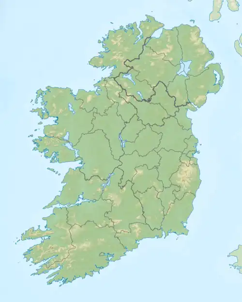 Maumtrasna Location in Ireland | |
| Location | County Mayo, Ireland |
| Parent range | Partry Mountains |
| OSI/OSNI grid | L961637 |
Maumtrasna, historically Formnamore (Irish: Formna Mór, 'the great shoulder'),[2] is the highest of the Partry Mountains in south County Mayo, Ireland, rising to 682 metres (2,238 ft) above sea level.[1] The summit is broad and flat with several ridges running off it, including Skeltia (An Scoltach), Benwee (Binn Bhuí), Buckaun (An Bocán)[2] and Binnaw (Binn Fheá).[3] The peak of Knocklaur (Cnoc Láir, 'middle hill') stands on the ridge between Maumtrasna and Devilsmother mountains.[4]
The name 'Maumtrasna' comes from Mám Trasna, meaning "the pass across", and originally meant the hill pass on the road between Lough Nafooey and Lough Mask.[2] The townland of Maumtrasna is on the south bank of the Srahnalong river. The townland was the location of the infamous Maumtrasna murders in 1882.
See also
References
- 1 2 3 "Maumtrasna 682m". MountainViews.ie.
- 1 2 3 Paul Tempan (2019). "Irish Landscape Names" (PDF). MountainViews.ie.
- ↑ "Binnaw". Placenames Database of Ireland.
- ↑ "Knocklaur 518m". MountainViews.ie.
| British Isles |  | |
|---|---|---|
| Scotland | ||
| Outside Scotland | ||
| England | ||
| Ireland | ||
| County tops | ||
| Northern Highlands (20) |    | |
|---|---|---|
| Western Highlands (20) | ||
| Central and Eastern Highlands (13) | ||
| Southern Highlands (15) | ||
| Islands (13) | ||
| Scottish Lowlands, England and Wales (13) | ||
| Republic of Ireland, Northern Ireland (25) | ||
Mountains and hills of Connacht | |||||||
|---|---|---|---|---|---|---|---|
| Achill Island | 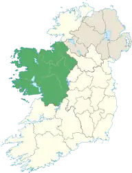 | ||||||
| Dartry Mountains | |||||||
| Maumturks | |||||||
| Mweelrea Mountains | |||||||
| Nephin Range | |||||||
| Ox Mountains | |||||||
| Partry Mountains | |||||||
| Sheeffry Range | |||||||
| Benna Beola |
| ||||||
| Others | |||||||