Macopin, New Jersey | |
|---|---|
| Coordinates: 41°03′08″N 74°23′20″W / 41.05222°N 74.38889°W | |
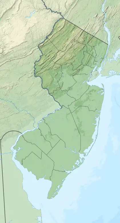
| Country | |
| State | |
| County | Passaic |
| Township | West Milford |
| Area | |
| • Total | 6.47 sq mi (16.76 km2) |
| • Land | 6.14 sq mi (15.89 km2) |
| • Water | 0.33 sq mi (0.86 km2) |
| Elevation | 1,004 ft (306 m) |
| Population | |
| • Total | 2,199 |
| • Density | 358.32/sq mi (138.36/km2) |
| ZIP Code | 07480 |
| FIPS code | 34-42450[3] |
| GNIS feature ID | 0878011[4] |
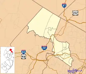

Macopin is an unincorporated community and census-designated place (CDP)[5] located within West Milford in Passaic County, in the U.S. state of New Jersey.[6] The area is served as United States Postal Service ZIP Code 07480.
Demographics
As of the 2020 United States census, the population was 2,199.[2] As of the 2000 United States Census, the population for ZIP Code Tabulation Area 07480 was 16,029.
| Census | Pop. | Note | %± |
|---|---|---|---|
| 2020 | 2,199 | — | |
| U.S. Decennial Census[7] | |||
References
- ↑ "ArcGIS REST Services Directory". United States Census Bureau. Retrieved October 11, 2022.
- 1 2 Census Data Explorer: Macopin CDP, New Jersey, United States Census Bureau. Accessed June 15, 2023.
- ↑ Geographic Codes Lookup for New Jersey, Missouri Census Data Center. Accessed June 9, 2023.
- ↑ "Macopin". Geographic Names Information System. United States Geological Survey, United States Department of the Interior. Retrieved September 23, 2012.
- ↑ State of New Jersey Census Designated Places - BVP20 - Data as of January 1, 2020, United States Census Bureau. Accessed December 1, 2022.
- ↑ Locality Search, State of New Jersey. Accessed June 9, 2016.
- ↑ "Census of Population and Housing". Census.gov. Retrieved June 4, 2016.
External links
Municipalities and communities of Passaic County, New Jersey, United States | ||
|---|---|---|
| Cities |  Map of New Jersey highlighting Passaic County | |
| Boroughs | ||
| Townships | ||
| CDPs | ||
| Other communities | ||
| Footnotes | ‡This populated place also has portions in an adjacent county or counties | |
This article is issued from Wikipedia. The text is licensed under Creative Commons - Attribution - Sharealike. Additional terms may apply for the media files.